Breakneck Road Historic District
Appearance
Breakneck Road Historic District | |
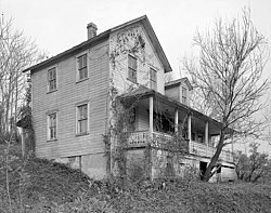
 William House residence in the 20th century | |
| Nearest city | Flintstone, Maryland |
|---|---|
| Coordinates | 39°40′40″N 78°36′45″W / 39.67778°N 78.61250°W |
| Area | 6,270 acres (2,540 ha) |
| Built by | Wilson, Harvey; Et al. |
| NRHP reference No. | 80001777[1] |
| Added to NRHP | May 29, 1980 |
The Breakneck Road Historic District is a rural agricultural landscape near Flintstone, Allegany County, Maryland. The farms and their associated lands have remained in the possession of a small number of families since the time of their settlement.[2]
It was listed on the National Register of Historic Places in 1980.[1]
References
[edit]- ^ a b "National Register Information System". National Register of Historic Places. National Park Service. July 9, 2010.
- ^ John D. Hnedek and Steven S. Levy (July 1977). "National Register of Historic Places Registration: Breakneck Road Historic District" (PDF). Maryland Historical Trust. Retrieved January 1, 2016.
External links
[edit]- Breakneck Road Historic District, Allegany County, including photo in 1978, at Maryland Historical Trust
- Boundary Map of the Breakneck Road Historic District, Allegany County, at Maryland Historical Trust
- Historic American Buildings Survey (HABS) No. MD-1081, "William House Farm, East side of West Wilson Road, Flintstone, Allegany County, MD", 7 photos, 9 data pages, 2 photo caption pages
- HABS No. MD-1081-A, "William House Farm, House", 10 photos, 21 data pages, 1 photo caption page
- HABS No. MD-1081-B, "William House Farm, Barn", 2 photos, 5 data pages, 1 photo caption page
Categories:
- Historic districts on the National Register of Historic Places in Maryland
- Historic districts in Allegany County, Maryland
- Historic American Buildings Survey in Maryland
- National Register of Historic Places in Allegany County, Maryland
- Western Maryland Registered Historic Place stubs
- Allegany County, Maryland, geography stubs


