Borynia Coal Mine
Appearance
You can help expand this article with text translated from the corresponding article in Polish. Click [show] for important translation instructions.
|
| Location | |
|---|---|
| Location | Jastrzębie-Zdrój |
| town | Silesian Voivodeship |
| Country | Poland |
| Coordinates | 49°59′58″N 018°36′46″E / 49.99944°N 18.61278°E |
| Production | |
| Products | Coal |
| Production | 3,400,000 |
| History | |
| Opened | 1971 |
| Owner | |
| Company | Jastrzębska Spółka Węglowa |
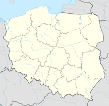
The Borynia coal mine is a large mine in the south of Poland in Jastrzębie-Zdrój, Silesian Voivodeship, 260 km south-west of the capital, Warsaw. Borynia has estimated reserves of 34 million tonnes of coal.[1] The annual coal production is around 3.4 million tonnes.
References
[edit]- ^ "KWK Borynia". Jastrzębska Spółka Węglowa. 2010. Archived from the original on 2010-08-10. Retrieved 2010-09-28.
External links
[edit]

