Boromo
Appearance
Boromo | |
|---|---|
Town | |
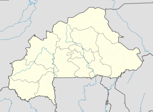
Location within Burkina Faso, French West Africa | |
| Coordinates: 11°45′N 2°56′W / 11.750°N 2.933°W | |
| Country | |
| Region | Boucle du Mouhoun Region |
| Province | Balé |
| Department | Boromo Department |
| Population (2019 census) | |
• Total | 20,193[1] |
| Time zone | UTC+0 (GMT) |
| ISO 3166 code | BFA |
Boromo is a town in the Boromo Department of Balé Province in Burkina Faso. It is the capital of both the department and the province, and it has a population of 20,193 (2019).[1]

Boromo is located directly between the two major cities of Burkina Faso, Ouagadougou and Bobo-Dioulasso. It is a city with many natural resources, including gold and fish. The major activity in this zone is agriculture. Boromo is a "melting pot" where you will find many ethnic groups, including Mossi, Dioula, Dafing, Bobo and Winiens (or Kos).

Climate
[edit]| Climate data for Boromo (1991–2020) | |||||||||||||
|---|---|---|---|---|---|---|---|---|---|---|---|---|---|
| Month | Jan | Feb | Mar | Apr | May | Jun | Jul | Aug | Sep | Oct | Nov | Dec | Year |
| Record high °C (°F) | 40.4 (104.7) |
42.8 (109.0) |
44.5 (112.1) |
44.2 (111.6) |
43.7 (110.7) |
41.1 (106.0) |
38.5 (101.3) |
35.7 (96.3) |
36.8 (98.2) |
39.4 (102.9) |
39.5 (103.1) |
39.2 (102.6) |
44.5 (112.1) |
| Mean daily maximum °C (°F) | 34.1 (93.4) |
37.0 (98.6) |
39.6 (103.3) |
39.7 (103.5) |
37.9 (100.2) |
35.0 (95.0) |
32.3 (90.1) |
31.1 (88.0) |
32.3 (90.1) |
35.4 (95.7) |
36.8 (98.2) |
34.9 (94.8) |
35.5 (95.9) |
| Daily mean °C (°F) | 25.6 (78.1) |
28.6 (83.5) |
31.7 (89.1) |
32.6 (90.7) |
31.3 (88.3) |
29.2 (84.6) |
27.2 (81.0) |
26.3 (79.3) |
26.9 (80.4) |
28.5 (83.3) |
28.0 (82.4) |
26.0 (78.8) |
28.5 (83.3) |
| Mean daily minimum °C (°F) | 17.0 (62.6) |
20.1 (68.2) |
24.3 (75.7) |
26.6 (79.9) |
26.1 (79.0) |
24.2 (75.6) |
22.9 (73.2) |
22.5 (72.5) |
22.5 (72.5) |
22.7 (72.9) |
19.3 (66.7) |
17.0 (62.6) |
22.1 (71.8) |
| Record low °C (°F) | 11.0 (51.8) |
13.6 (56.5) |
16.4 (61.5) |
19.4 (66.9) |
19.3 (66.7) |
19.0 (66.2) |
19.4 (66.9) |
19.3 (66.7) |
19.2 (66.6) |
17.0 (62.6) |
13.4 (56.1) |
11.0 (51.8) |
11.0 (51.8) |
| Average precipitation mm (inches) | 0.8 (0.03) |
1.0 (0.04) |
5.3 (0.21) |
42.6 (1.68) |
79.7 (3.14) |
118.9 (4.68) |
200.4 (7.89) |
261.2 (10.28) |
157.8 (6.21) |
52.9 (2.08) |
1.5 (0.06) |
0.0 (0.0) |
922.1 (36.30) |
| Average precipitation days (≥ 1.0 mm) | 0.1 | 0.2 | 1.0 | 3.1 | 6.4 | 8.3 | 12.5 | 15.0 | 12.0 | 4.9 | 0.3 | 0.0 | 63.8 |
| Mean monthly sunshine hours | 268.4 | 244.0 | 248.2 | 232.7 | 242.9 | 222.8 | 209.7 | 194.0 | 222.3 | 267.5 | 277.0 | 271.7 | 2,901.2 |
| Source: NOAA[2] | |||||||||||||
See also
[edit]References
[edit]- ^ a b "Burkina Faso: Cities & Localities". Thomas Brinkhoff, Citypopulation. Retrieved 12 November 2019.
- ^ "World Meteorological Organization Climate Normals for 1991-2020 — Boromo". National Oceanic and Atmospheric Administration. Retrieved January 4, 2024.
External links
[edit]


