Bonita, Arizona
Appearance

Bonita, Arizona | |
|---|---|
![The Bonita Store in Bonita, formerly a saloon where William H. Bonny AKA Billy The Kid shot a local blacksmith for bulling him[citation needed]](http://upload.wikimedia.org/wikipedia/commons/thumb/9/99/Bonita_Store.JPG/250px-Bonita_Store.JPG) The Bonita Store in Bonita, formerly a saloon where William H. Bonny AKA Billy The Kid shot a local blacksmith for bulling him[citation needed] | |
| Coordinates: 32°35′23″N 109°58′09″W / 32.58972°N 109.96917°W | |
| Country | United States |
| State | Arizona |
| County | Graham |
| Elevation | 4,544 ft (1,385 m) |
| Time zone | UTC-7 (Mountain (MST)) |
| Area code | 928 |
| GNIS feature ID | 24330[1] |
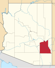
Bonita is an unincorporated community in Graham County, Arizona, United States. Bonita is located on Arizona State Route 266, 2.6 miles (4.2 km) south-southwest of Fort Grant and 22.7 miles (36.5 km) southwest of Safford.


