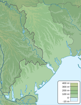
Berehove, Odesa Oblast
Berehove
Берегове Beregove, Beregovoye, Берегове | |
|---|---|
| Coordinates: 46°42′25″N 30°32′32″E / 46.70694°N 30.54222°E | |
| Country | |
| Oblast | |
| Raion | |
| Hromada | Usatove rural hromada |
| Area | |
| • Land | 0.35 km2 (0.14 sq mi) |
| Population (2001) | |
| • Total | 45 |
| Time zone | UTC+2 (EET (Kyiv)) |
| • Summer (DST) | UTC+3 (EEST) |
| Postal Code | 67631 |
| Address | 67663, Odesa Oblast, Odesa Raion, Usatove Hromada, Government Avenue, 3 |
 | |
Berehove (Ukrainian: Берегове) is a village in Ukraine, Odesa Raion, in Odesa Oblast. It belongs to Usatove rural hromada, one of the hromadas of Ukraine,[1] and is one of the 15 villages in the hromada. It has a population of about 45 (As of the Ukrainian 2001 Population Census).[2] It has 2 other names that can you can call Berehove: Beregove and Beregovoye.
Until 18 July 2020, Berehove belonged to Biliaivka Raion. The raion was abolished in July 2020 as part of the administrative reform of Ukraine, which reduced the number of raions of Odesa Oblast to seven. The area of Biliaivka Raion was merged into Odesa Raion.[3][4]
Population census
[edit]As of January 12, 1989, Berehove had a population of 43 people. [2] Archived 2014-07-31 at the Wayback Machine
On December 5, 2001, Berehove had a population of 36 people (7 fewer people than 1989). [3] Archived 2014-07-31 at the Wayback Machine
| Year and Gender | 1989 Census | 2001 Census |
|---|---|---|
| Men | 21 | 16 |
| Women | 22 | 20 |
See also
[edit]References
[edit]- ^ "Усатовская громада" (in Russian). Портал об'єднаних громад України.
- ^ [1] Archived 2014-07-31 at the Wayback Machine
- ^ "Про утворення та ліквідацію районів. Постанова Верховної Ради України № 807-ІХ". Голос України (in Ukrainian). 2020-07-18. Retrieved 2020-10-03.
- ^ "Нові райони: карти + склад" (in Ukrainian). Міністерство розвитку громад та територій України.
- ^ "Банк даних". Archived from the original on 2014-07-31. Retrieved 2022-05-14.


