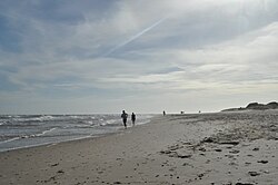
Bello Horizonte
Appearance
Bello Horizonte | |
|---|---|
Village, resort | |
 | |
| Coordinates: 34°46′20″S 55°38′38″W / 34.77222°S 55.64389°W | |
| Country | |
| Department | Canelones |
| Municipality | La Floresta |
| Population (2011) | |
| • Total | 416 |
| Time zone | UTC -3 |
| Postal code | 16203 |
| Dial plan | +598 437 (+5 digits) |
Bello Horizonte is a village and resort on the Costa de Oro (Coast of Gold), in the Canelones Department of southern Uruguay.
Geography
[edit]Bello Horizonte is located in the south of the department of Canelones, on the shores of the Río de la Plata, at km 57 of the Ruta Interbalnearia. It bordered to the west with the Costa Azul resort and to the east with the Guazú-Virá resort.[1][2]
Population
[edit]In 2011 Bello Horizonte had a population of 416.[3]
References
[edit]- ^ "Índice toponimico de entidades de población". Instituto Nacional de Estadística. Archived from the original (doc) on 14 March 2012. Retrieved 29 July 2012.
- ^ "Guía de Tránsito y Transporte del Uruguay". Ministerio de Transporte y Obras Públicas. Archived from the original on 10 July 2012. Retrieved 29 July 2012.
- ^ "Censos 2011 Canelones (flash plugin needed)". INE. 2012. Archived from the original on 7 September 2012. Retrieved 6 January 2014.

