Beleh Keh Rural District
Appearance
Beleh Keh Rural District
Persian: دهستان بله كه | |
|---|---|
| Coordinates: 35°51′35″N 45°44′57″E / 35.85972°N 45.74917°E[1] | |
| Country | Iran |
| Province | Kurdistan |
| County | Baneh |
| District | Armardeh |
| Capital | Beleh Keh |
| Population (2016)[2] | |
• Total | 2,448 |
| Time zone | UTC+3:30 (IRST) |
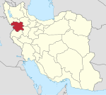
Beleh Keh Rural District (Persian: دهستان بله كه)[3] is in Armardeh District[a] of Baneh County, Kurdistan province, Iran. Its capital is the village of Beleh Keh.[5]
Demographics
[edit]Population
[edit]At the time of the 2006 National Census, the rural district's population was 2,691 in 516 households.[6] There were 2,546 inhabitants in 563 households at the following census of 2011.[7] The 2016 census measured the population of the rural district as 2,448 in 649 households. The most populous of its 11 villages was Kandeh Sureh, with 736 people.[2]
See also
[edit]Notes
[edit]References
[edit]- ^ OpenStreetMap contributors (16 August 2023). "Beleh Keh Rural District (Baneh County)" (Map). OpenStreetMap (in Persian). Retrieved 16 August 2023.
- ^ a b "Census of the Islamic Republic of Iran, 1395 (2016)". AMAR (in Persian). The Statistical Center of Iran. p. 12. Archived from the original (Excel) on 8 May 2022. Retrieved 19 December 2022.
- ^ Iranian National Committee for Standardization of Geographical Names website (in Persian)
- ^ Davoodi, Parviz (3 April 1388). "Changing the name of Alut District from the functions of Baneh County in Kurdistan province to Armardeh District". Qavanin (in Persian). Ministry of Interior, Political and Defense Commission. Archived from the original on 15 August 2023. Retrieved 15 August 2023.
- ^ Habibi, Hassan (12 December 1371). "Creation of 48 rural districts in several rural areas of the country". Laws and Regulations Portal of the Islamic Republic of Iran (in Persian). Ministry of Interior, Political-Defense Commission of the Government Council. Archived from the original on 28 November 2018. Retrieved 2 January 2024.
- ^ "Census of the Islamic Republic of Iran, 1385 (2006)". AMAR (in Persian). The Statistical Center of Iran. p. 12. Archived from the original (Excel) on 20 September 2011. Retrieved 25 September 2022.
- ^ "Census of the Islamic Republic of Iran, 1390 (2011)". Syracuse University (in Persian). The Statistical Center of Iran. p. 12. Archived from the original (Excel) on 19 January 2023. Retrieved 19 December 2022.


