Beinn a' Chlachair
Appearance
| Beinn a' Chlachair | |
|---|---|
 Beinn a' Chlachair from the Allt Meall Ardruighe reservoir | |
| Highest point | |
| Elevation | 1,087 m (3,566 ft)[1] |
| Prominence | 539 m (1,768 ft) |
| Listing | Munro, Marilyn |
| Coordinates | 56°52′10″N 4°30′35″W / 56.8695°N 4.5096°W |
| Geography | |
 | |
| Location | Highland, Scotland |
| Parent range | Grampian Mountains |
| OS grid | NN471781 |
| Topo map | OS Landranger 42 |
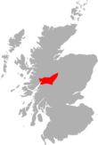
Beinn a' Chlachair (1,087 m) is a mountain in the Grampian Mountains of Scotland. It lies south of Loch Laggan, near the remote hamlet of Kinloch Laggan.
The highest of a group of three Munros, the mountain has a spacious plateau on its summit, while three of sides are steep. There is a corrie on its northern face.[2]
References
[edit]- ^ "Beinn a'Chlachair". hill-bagging.co.uk. Retrieved 9 May 2019.
- ^ "walkhighlands Beinn a'Chlachair". walkhighlands.co.uk. Retrieved 9 May 2019.


