Beaches of Aruba
Appearance

There are more than a dozen beaches of Aruba. Aruba is part of the Kingdom of the Netherlands and an island country in the mid-south of the Caribbean Sea.
Beaches
[edit]The beaches of Aruba include the following:
- Andicuri Beach, 12°32′25″N 69°57′15″W / 12.54017°N 69.95405°W[1]
- Arashi Beach, 12°36′34″N 70°03′14″W / 12.60955°N 70.05398°W[2][1]
- Baby Beach, 12°24′53″N 69°52′51″W / 12.414691561947045°N 69.88080110113886°W[1][3]
- Bachelor's Beach, 12°25′55″N 69°52′19″W / 12.432048879438073°N 69.87190087340504°W[3]
- Beach at the Blue Residences, 12°33′42″N 70°03′17″W / 12.561552177770563°N 70.05461831601973°W[3]
- Boca Catalina Beach, 12°36′17″N 70°03′06″W / 12.604599275220952°N 70.05154788992112°W[1][3]
- Boca Grandi Beach, 12°26′25″N 69°52′26″W / 12.440179110955492°N 69.87391789463777°W[3]
- Boca Prins Beach, Arikok National Park, 12°29′57″N 69°54′25″W / 12.499268155134015°N 69.90690549769073°W[1][3]
- Cura Cabay Beach, 12°26′25″N 69°55′49″W / 12.440230544063645°N 69.93035316884772°W
- Daimari Beach, 12°31′52″N 69°56′25″W / 12.53097730179607°N 69.9402757457267°W[3]
- Divi Beach, 12°32′15″N 70°03′34″W / 12.537543549026955°N 70.05944983277939°W[3]
- Dos Playa Beach, Arikok National Park, 12°30′21″N 69°55′08″W / 12.505709317860248°N 69.91879125150759°W[1]
- Druif Beach, 12°36′20″N 70°01′54″W / 12.60569°N 70.0318°W[1][4]
- Eagle Beach, 12°32′52″N 70°03′25″W / 12.54786°N 70.0569°W[5][1]
- Flamingo Beach, Renaissance Island, 12°30′05″N 70°01′46″W / 12.50127°N 70.02953°W[6]
- Grapefield Beach, 12°26′55″N 69°52′37″W / 12.448602432969578°N 69.8770077994854°W
- Hadicurari Beach, 12°35′09″N 70°02′46″W / 12.585830474743323°N 70.04606410264978°W[1][3]
- Iguana Beach, 12°30′01″N 70°01′42″W / 12.50036°N 70.02834°W[7]
- Malmok Beach, 12°35′53″N 70°02′59″W / 12.598006661360682°N 70.04978184187625°W[1][3]
- Manchebo Beach, 12°32′25″N 70°03′48″W / 12.54024°N 70.06342°W[8]
- Mangel Halto Beach, 12°27′54″N 69°58′10″W / 12.464923508766375°N 69.96952414935305°W[3]
- Palm Beach, 12°34′31″N 70°02′45″W / 12.575175775385796°N 70.04573530313544°W[9][1][3]
- De Palm Island, 12°28′20″N 69°59′10″W / 12.472150386817194°N 69.98618229648267°W[1][3]
- Rincon Beach, 12°27′17″N 69°52′47″W / 12.454731170852979°N 69.87963636429994°W[3]
- Rodgers Beach, 12°25′02″N 69°53′03″W / 12.41719°N 69.88413°W[10][1]
- Surfside Beach, 12°30′23″N 70°01′49″W / 12.5063215093638°N 70.03022095363487°W[1][3]
- Wariruri Beach, 12°33′33″N 69°59′17″W / 12.559253559320023°N 69.98819072756311°W[3]
Gallery
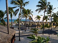
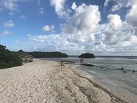
[edit]Beach scenes in Aruba
See also
[edit]Wikimedia Commons has media related to Aruba.
Wikivoyage has a travel guide for Aruba.
References
[edit]- ^ a b c d e f g h i j k l m n "Aruba's Beaches and Coves". Aruba.com. Retrieved September 21, 2021.
- ^ "Arashi Cove". GeoNames. Retrieved September 21, 2021.
- ^ a b c d e f g h i j k l m n o p Google Maps
- ^ "Druif Beach". GeoNames. Retrieved September 21, 2021.
- ^ "Eagle Beach". GeoNames. Retrieved September 21, 2021.
- ^ "Flamingo Beach". GeoNames. Retrieved September 21, 2021.
- ^ "Iguana Beach". GeoNames. Retrieved September 21, 2021.
- ^ "Manchebo Beach". GeoNames. Retrieved September 21, 2021.
- ^ "Palm Beach". GeoNames. Retrieved September 21, 2021.
- ^ "Rodgers Beach". GeoNames. Retrieved September 21, 2021.


