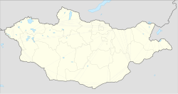
Bayangol, Selenge
Appearance
Bayangol District
Баянгол сум ᠪᠠᠶ᠋ᠠᠩᠭ᠋ᠣᠤᠯᠰᠤᠮᠤ | |
|---|---|
| Coordinates: 48°54′53″N 106°5′15″E / 48.91472°N 106.08750°E | |
| Country | Mongolia |
| Province | Selenge Province |
| Area | |
• Total | 1,976.28 km2 (763.05 sq mi) |
| Elevation | 760 m (2,496 ft) |
| Population (2008) | |
• Total | 5,028 |
| Time zone | UTC+8 (UTC + 8) |
| Climate | Dwb |
Bayangol (Mongolian: Баянгол, Mongolian: rich river) is a sum (district) of Selenge Province in northern Mongolia. The capital town of the district is officially named Baruunkharaa. In 2008, its population was 5,028.[2]
Climate
[edit]Bayangol has a humid continental climate (Köppen climate classification Dwb) with warm summers and severely cold winters. Most precipitation falls in the summer as rain, with some snow in the adjacent months of May and September. Winters are mostly dry, with occasional snowfalls.
| Climate data for Baruunkharaa (Bayangol) 1991-2020 normals, extremes 1940-present | |||||||||||||
|---|---|---|---|---|---|---|---|---|---|---|---|---|---|
| Month | Jan | Feb | Mar | Apr | May | Jun | Jul | Aug | Sep | Oct | Nov | Dec | Year |
| Record high °C (°F) | 2.0 (35.6) |
12.6 (54.7) |
21.8 (71.2) |
33.2 (91.8) |
36.0 (96.8) |
40.2 (104.4) |
42.6 (108.7) |
41.0 (105.8) |
33.8 (92.8) |
28.0 (82.4) |
17.5 (63.5) |
6.4 (43.5) |
42.6 (108.7) |
| Mean daily maximum °C (°F) | −17.8 (0.0) |
−10.6 (12.9) |
1.4 (34.5) |
11.0 (51.8) |
19.6 (67.3) |
24.3 (75.7) |
27.1 (80.8) |
23.3 (73.9) |
18.2 (64.8) |
9.7 (49.5) |
−3.0 (26.6) |
−13.9 (7.0) |
7.4 (45.4) |
| Daily mean °C (°F) | −24.7 (−12.5) |
−19.0 (−2.2) |
−6.2 (20.8) |
4.5 (40.1) |
11.7 (53.1) |
18.1 (64.6) |
20.5 (68.9) |
17.9 (64.2) |
11.0 (51.8) |
1.4 (34.5) |
−10.5 (13.1) |
−20.9 (−5.6) |
0.3 (32.6) |
| Mean daily minimum °C (°F) | −30.1 (−22.2) |
−25.8 (−14.4) |
−14.6 (5.7) |
−4.6 (23.7) |
2.7 (36.9) |
9.2 (48.6) |
13.7 (56.7) |
11.4 (52.5) |
3.2 (37.8) |
−6.1 (21.0) |
−17.6 (0.3) |
−27.0 (−16.6) |
−7.1 (19.2) |
| Record low °C (°F) | −47 (−53) |
−43.9 (−47.0) |
−38.9 (−38.0) |
−23.0 (−9.4) |
−15.0 (5.0) |
−3.9 (25.0) |
−1.0 (30.2) |
−7.0 (19.4) |
−11.4 (11.5) |
−25.0 (−13.0) |
−36.2 (−33.2) |
−40.9 (−41.6) |
−47.0 (−52.6) |
| Average precipitation mm (inches) | 3.9 (0.15) |
3.2 (0.13) |
4.3 (0.17) |
8.7 (0.34) |
18.5 (0.73) |
47.8 (1.88) |
62.3 (2.45) |
59.6 (2.35) |
34.6 (1.36) |
11.4 (0.45) |
5.8 (0.23) |
5.0 (0.20) |
265.1 (10.44) |
| Average precipitation days (≥ 1.0 mm) | 1.0 | 0.8 | 1.0 | 2.0 | 3.7 | 6.6 | 9.3 | 9.5 | 4.8 | 2.5 | 1.6 | 1.7 | 44.5 |
| Source 1: Pogoda.ru.net [3] | |||||||||||||
| Source 2: NOAA (precipitation 1961-1990),[4] Meteo Climat (record highs and lows)[5] | |||||||||||||
References
[edit]- ^ "Baruunharaa, Mongolia". Falling Rain Global Gazetteer. Retrieved 27 January 2013.
- ^ Selenge Aimag Statistical Office. Selenge Aimag Sums Review 2000-2008 Archived July 22, 2011, at the Wayback Machine
- ^ КЛИМАТ УЛАН-БАТОРА (in Russian). Pogoda.ru.net. Retrieved 4 January 2015.
- ^ "Baruunkharaa Climate Normals 1961-1990". National Oceanic and Atmospheric Administration. Retrieved January 13, 2013.
- ^ "Station Baruunkharaa" (in French). Meteo Climat. Retrieved 10 October 2018.

