Baksila
Baksila
बाक्सिला | |
|---|---|
| Coordinates: 27°20′N 86°50′E / 27.33°N 86.83°E | |
| Country | |
| Zone | Sagarmatha Zone |
| District | Khotang District |
| Population (1991) | |
• Total | 3,996 |
| Time zone | UTC+5:45 (Nepal Time) |
| Area code | 036 |
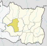
Baksila is a village and village development committee in Khotang District in the Sagarmatha Zone of eastern Nepal. At the time of the 1991 Nepal census it had a population of 3,996 persons living in 796 individual households.[1] Baksila is a five hours walk from Diktel, headquarters of Khotang District. Surrounded by Baspani, Sungdel, Dipsung, Rakha Saptewor and Kharmi, the village is split into nine wards geographically. It became the headquarters of Kepilasgadhi rural municipality after the local level division in line with the constitution and local level election. It is ward number 4 of Kepilasgadhi RM and Ganesh Bahadur Adhikari is the chairperson of ward. Shree Prithvi Higher Secondary School, Local Buddha Bajar, Kepilasgadhi, etc. are the main places/offices.
References
[edit]- ^ "Nepal Census 2001". Nepal's Village Development Committees. Digital Himalaya. Archived from the original on 12 October 2008. Retrieved 30 September 2008.
External links
[edit]


