Bako, Oromia
Bako
Bakkoo (Oromo) | |
|---|---|
Town | |
| Coordinates: 9°08′N 37°03′E / 9.133°N 37.050°E | |
| Country | |
| Region | |
| Zone | West Shewa Zone |
| Woreda | Bako Tibe |
| Population (2005) | |
| • Total | 18,641 |
| Time zone | UTC+3 (EAT) |
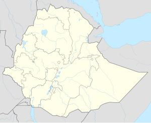
Bako is a town in central Ethiopia. Located in the West Shewa Zone of the Oromia, on the all-weather highway between Addis Ababa (Finfinne) and Naqamte, this town has a longitude and latitude of 9°08′N 37°03′E / 9.133°N 37.050°E with an elevation of 1,743 metres or 5,719 feet above sea level. Bako is the administrative center of Bako Tibe Aanaa.
During the Italian occupation, Bako is mentioned as having a medical clinic and a school. In 1948, Swedish missionaries opened a medical clinic in the town, which evolved into a mission station by 1953. By 1967, the town had phone service, as well as a primary and junior secondary schools; there was also a school for the blind, which had been moved from Addis Ababa to Bako 1961.[1] The Ethiopian Institute of Agricultural Research opened a center in Bako in 1968, which is the national center for improving the yield of maize.[2]
Based on figures from the Central Statistical Agency in 2005, Bako has an estimated total population of 18,641 of whom 9,370 are men and 9,271 women.[3] The 1994 census reported this town had a total population of 10,422 of whom 5,082 were men and 5,340 women. It is the largest of three towns in Bako Tibe.
Climate
[edit]Bako has a warm subtropical highland climate (Köppen Cwb) with a short dry season in December and January and a lengthy though not intense wet season covering the remaining ten months of the year.
| Climate data for Bako, elevation 1,590 m (5,220 ft), (1971–2000) | |||||||||||||
|---|---|---|---|---|---|---|---|---|---|---|---|---|---|
| Month | Jan | Feb | Mar | Apr | May | Jun | Jul | Aug | Sep | Oct | Nov | Dec | Year |
| Mean daily maximum °C (°F) | 29.3 (84.7) |
29.9 (85.8) |
30.5 (86.9) |
30.5 (86.9) |
28.2 (82.8) |
25.6 (78.1) |
23.6 (74.5) |
23.9 (75.0) |
25.0 (77.0) |
27.0 (80.6) |
27.5 (81.5) |
28.2 (82.8) |
27.4 (81.4) |
| Mean daily minimum °C (°F) | 10.3 (50.5) |
12.3 (54.1) |
12.9 (55.2) |
14.3 (57.7) |
14.1 (57.4) |
13.6 (56.5) |
13.9 (57.0) |
13.6 (56.5) |
13.1 (55.6) |
11.3 (52.3) |
10.1 (50.2) |
9.6 (49.3) |
12.4 (54.4) |
| Average precipitation mm (inches) | 16.0 (0.63) |
29.0 (1.14) |
61.0 (2.40) |
69.0 (2.72) |
130.0 (5.12) |
199.0 (7.83) |
269.0 (10.59) |
198.0 (7.80) |
151.0 (5.94) |
55.0 (2.17) |
34.0 (1.34) |
16.0 (0.63) |
1,227 (48.31) |
| Average relative humidity (%) | 51 | 52 | 49 | 48 | 65 | 75 | 79 | 80 | 78 | 67 | 59 | 54 | 63 |
| Source: FAO[4] | |||||||||||||
Notes
[edit]- ^ "Local History in Ethiopia" Archived 2008-04-08 at the Wayback Machine The Nordic Africa Institute website (accessed 2 March 2009)
- ^ EARI list of research centers Archived 2009-04-23 at the Wayback Machine (accessed 30 April 2009)
- ^ CSA 2005 National Statistics Archived 2008-11-18 at the Wayback Machine, Table B.4
- ^ "CLIMWAT climatic database". Food and Agriculture Organization of United Nations. Retrieved 21 June 2024.


