B. Pallipatti
Appearance
This article needs additional citations for verification. (February 2022) |
B.Pallipatti
Bairanatham Pallipatti | |
|---|---|
Village panchayat | |
 A Road side sign board of this village | |
| Nickname: Pallipatti | |
| Coordinates: 11°56′49″N 78°16′48″E / 11.947°N 78.28°E | |
| Country | |
| State | Tamil Nadu |
| Region | Kongu Nadu |
| District | Dharmapuri |
| Block | Pappireddipatti[2] |
| Panchayat | B Pallipatti |
| Government | |
| • Type | Panchayat |
| Population (2011) | |
| • Total | 3,684[1] |
| Languages | |
| • Official | Tamil |
| Time zone | UTC+5:30 (IST) |
| PIN | 635301[3] |
| Telephone code | 91-4346 |
| Vehicle registration | TN 29 |
| Lok Sabha Constituency | Dharmapuri |
| Assembly Constituency | Pappireddipatti |
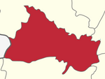
B. Pallipatti is a village in the Dharmapuri district of the Indian state of Tamil Nadu. The village code is 643526, and it is under the jurisdiction of B. Pallipatti Grama panchayath.[4]
Location
[edit]The town is located 38 km from the district capital Dharmapuri and 11 km from Pappireddipatti. It also has an average elevation of 340 meters above sea level. The nearest town is Bommidi.
Population classification
[edit]In 2011, the town had 876 families and 3684 people. Of these, 1942 were males and 1742 were females. Here is a government-aided primary school with 420 students. Our Lady of Lourde Church is famous in this town.[citation needed]
See also
[edit]References
[edit]- ^ "NPR Report". Censusindia.gov.in. Retrieved 6 February 2022.
- ^ "Tahsildar-Pappireddipatti | Dharmapuri District, Government of Tamil Nadu | India". Dharmapuri.nic.in. Retrieved 6 February 2022.
- ^ "Pin Code: 643226, List of Post Offices, NILGIRIS, TAMIL NADU". Pincode.net.in.
- ^ "Revenue Administration | Dharmapuri District, Government of Tamil Nadu | India". Sharmapuri.nic.in. Retrieved 6 February 2022.


