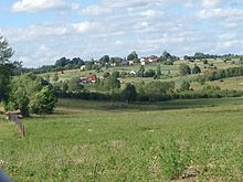
Błotnia, Pomeranian Voivodeship
Appearance
Błotnia | |
|---|---|
Village | |
| Coordinates: 54°10′31″N 18°24′1″E / 54.17528°N 18.40028°E | |
| Country | |
| Voivodeship | Pomeranian |
| County | Gdańsk |
| Gmina | Trąbki Wielkie |
| Population | 187 |
Błotnia [ˈbwɔtɲa] is a village in the administrative district of Gmina Trąbki Wielkie, within Gdańsk County, Pomeranian Voivodeship, in northern Poland.[1] It lies approximately 10 kilometres (6 mi) west of Trąbki Wielkie, 19 km (12 mi) south-west of Pruszcz Gdański, and 27 km (17 mi) south-west of the regional capital Gdańsk. The name of Błotnia was Braunsdorf (County Danzig, Free City of Danzig) till the end of World War II.
For details of the history of the region, see History of Pomerania.

References
[edit]

