Bělčice
Bělčice | |
|---|---|
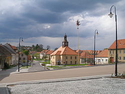
 Town square with the town hall | |
| Coordinates: 49°30′9″N 13°52′33″E / 49.50250°N 13.87583°E | |
| Country | |
| Region | South Bohemian |
| District | Strakonice |
| First mentioned | 1243 |
| Area | |
| • Total | 34.33 km2 (13.25 sq mi) |
| Elevation | 526 m (1,726 ft) |
| Population (2024-01-01)[1] | |
| • Total | 996 |
| • Density | 29/km2 (75/sq mi) |
| Time zone | UTC+1 (CET) |
| • Summer (DST) | UTC+2 (CEST) |
| Postal code | 387 43 |
| Website | www |
Bělčice is a town in Strakonice District in the South Bohemian Region of the Czech Republic. It has about 1,000 inhabitants.
Administrative parts
[edit]The villages of Hostišovice, Podruhlí, Tisov, Újezdec, Záhrobí and Závišín are administrative parts of Bělčice.
Etymology
[edit]The name Bělčice is derived from the personal name Bělec (or Bílek), meaning "the village of Bělec's people".[2]
Geography
[edit]Bělčice is located about 27 kilometres (17 mi) north of Strakonice and 43 km (27 mi) southeast of Plzeň. It lies on the border between the Blatná Uplands and Benešov Uplands. The highest point is the hill Kněžská hora at 565 metres (1,854 ft) above sea level. The area is rich in fishponds and minor streams.
History
[edit]The first written mention of Bělčice is from 1243.[3] At the end of the 15th century, the village was promoted to a town. Bělčice was badly damaged during the Thirty Years' War and ceased to be a town. In 1898, it became a town again.[4]
Demographics
[edit]
|
|
| ||||||||||||||||||||||||||||||||||||||||||||||||||||||
| Source: Censuses[5][6] | ||||||||||||||||||||||||||||||||||||||||||||||||||||||||
Transport
[edit]Bělčice is located on the railway line Strakonice–Beroun.[7]
Sights
[edit]
The main landmark of Bělčice is the Church of Saints Peter and Paul. It was built in the late Romanesque style around 1240. The Gothic presbytery was built in the beginning of the 14th century. Next to the church is a separate neo-Gothic bell tower from 1863.[8]
References
[edit]- ^ "Population of Municipalities – 1 January 2024". Czech Statistical Office. 2024-05-17.
- ^ Profous, Antonín (1947). Místní jména v Čechách I: A–H (in Czech). p. 48.
- ^ "Město Bělčice" (in Czech). Město Bělčice. Retrieved 2023-10-30.
- ^ "Historie" (in Czech). Město Bělčice. Retrieved 2023-10-30.
- ^ "Historický lexikon obcí České republiky 1869–2011" (in Czech). Czech Statistical Office. 2015-12-21.
- ^ "Population Census 2021: Population by sex". Public Database. Czech Statistical Office. 2021-03-27.
- ^ "Detail stanice Bělčice" (in Czech). České dráhy. Retrieved 2023-10-30.
- ^ "Kostel sv. Petra a Pavla" (in Czech). National Heritage Institute. Retrieved 2023-10-30.


