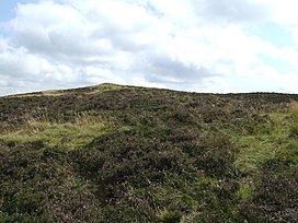
Ark Hill
Appearance
| Ark Hill | |
|---|---|
 | |
| Highest point | |
| Elevation | 339 m (1,112 ft) |
| Prominence | 36 m (118 ft) |
| Listing | Marilyn |
| Geography | |
 | |
| Location | Angus, Scotland |
| Parent range | Sidlaw Hills |
| Topo map | OS Landranger 53 |
| Climbing | |
| Easiest route | Walk up to summit |
Ark Hill is a mountainous landform within the Sidlaw Hills in Angus, Scotland. This location has been proposed as a windfarm for generating renewable electrical power.[1] Approximately two kilometres to the north is the village of Eassie noted for the presence of the Eassie Stone; this carved Pictish stone is dated prior to the Early Middle Ages.[2]
