Ardattin
Appearance

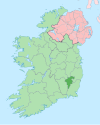
Ardattin (Irish: Ard Aitinn, meaning 'high gorse')[1] is a village and townland in County Carlow, Ireland,[2][3] 6 km south of Tullow. It lies in the civil parish of Ardoyne in the historical barony of Forth.[1][2] As of the 2011 census, the townland had a population of 34 people.[4]
The local Roman Catholic church, the Church of the Immaculate Conception, was built in 1954 and is in Tullow Parish of the Diocese of Kildare and Leighlin.[5][6] There is a pub in the area.[7]
People
[edit]- Pierce Butler, slaveholder and Founding Father of the United States[3]
- Saoirse Ronan, actress[8]
References
[edit]- ^ a b "Ard Aitinn / Ardattin". logainm.ie. Irish Placenames Commission. Retrieved 26 December 2019.
- ^ a b "Ardattin Townland, Co. Carlow". townlands.ie. Retrieved 29 January 2022.
- ^ a b "Ardattin". Carlow Tourism. Retrieved 29 January 2022.
- ^ "CD150 - Carlow Population by Private Households, Occupied and Vacancy Rate". data.gov.ie. Central Statistics Office. Retrieved 1 June 2022.
- ^ "Catholic Church of the Immaculate Conception, Ardattin, Carlow". buildingsofireland.ie. National Inventory of Architectural Heritage. Retrieved 29 January 2022.
- ^ "The Church of the Immaculate Conception, Ardattin". tullowparish.com. Retrieved 29 January 2022.
- ^ "The Ardattin Inn". ie.publocation.com.
- ^ "The double life of Saoirse". irishtimes.com. Irish Times. 1 September 2007. Retrieved 29 January 2022.
52°45′14″N 6°42′25″W / 52.754°N 6.707°W

