Archeda
Appearance
| Archeda | |
|---|---|
 | |
| Native name | Арчеда (Russian) |
| Location | |
| Country | Russia |
| Physical characteristics | |
| Mouth | Medveditsa |
• coordinates | 49°52′39″N 43°09′31″E / 49.8775°N 43.1586°E |
| Length | 162 km (101 mi) |
| Basin size | 2,050 km2 (790 sq mi) |
| Basin features | |
| Progression | Medveditsa→ Don→ Sea of Azov |
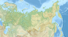
The Archeda (Russian: Арчеда) is a river in Volgograd Oblast, Russia. It is a left tributary of the Medveditsa, and is 162 kilometres (101 mi) long, with a drainage basin of 2,050 square kilometres (790 sq mi).[1] The Archeda begins in the southwestern part of the Volga Uplands. Most of its water comes from melting snow, and during periods of low water the river dries up entirely in its upper and middle flow. The town of Frolovo lies along the Archeda.
References
[edit]- ^ «Река Арчеда (Арчада)», Russian State Water Registry

