History of Maryland

The recorded history of Maryland dates back to the beginning of European exploration, starting with the Venetian John Cabot, who explored the coast of North America for the Kingdom of England in 1498. After European settlements had been made to the south and north, the colonial Province of Maryland was granted by King Charles I to Sir George Calvert (1579–1632), his former Secretary of State in 1632, for settlement beginning in March 1634. It was notable for having been established with religious freedom for Roman Catholics, since Calvert had publicly converted to that faith.[1][2][3] Like other colonies and settlements of the Chesapeake Bay region, its economy was soon based on tobacco as a commodity crop, highly prized among the English, cultivated primarily by African slave labor, although many young people came from Britain sent as indentured servants or criminal prisoners in the early years.
In 1781, during the American Revolutionary War (1775–1783), Maryland became the seventh state of the United States to ratify the Articles of Confederation and Perpetual Union. They were drawn up by a committee of the Second Continental Congress (1775–1781), which began shortly after the adoption of a Declaration of Independence in July 1776, to 1778. Later that year, these articles were recommended to the newly independent sovereign states via their legislatures for the required unanimous ratification. This long process was held up for three years by objections from smaller states led by Maryland until certain issues and principles over the western lands beyond the Appalachian Mountains to the Mississippi River. These objections were resolved with the larger states agreeing to cede their various western claims to the authority of the new Congress of the Confederation, representing all the states, to be held in common for the laying out and erection of new states out of the jointly held federal territories. Maryland then finally agreed to join the new American confederation by being one of the last of the former colonies ratifying the long proposed Articles in 1781, when they took effect. Later that same decade, Maryland became the seventh state to ratify the stronger government structure proposed in the new U.S. Constitution in 1788.
After the Revolutionary War, numerous Maryland planters freed their slaves as the economy changed. Baltimore grew to become one of the largest cities on the eastern seaboard, and a major economic force in the country. Although Maryland was still a slave state in 1860, by that time nearly half of the African American population was free, due mostly to manumissions after the American Revolution.[4] Baltimore had the highest number of free people of color of any city in the United States. Maryland was among the four divided border states during the American Civil War (1861–1865), with most Marylanders fighting for the Union Army, along with a large number for the Confederacy. As a border state, it officially remained in the Union throughout the war.
Precolonial history
[edit]| History of Maryland |
|---|
|
|
It appears that the first humans in the area that would become Maryland arrived around the tenth millennium BC, about the time that the last ice age ended. They were hunter-gatherers organized into semi-nomadic bands. They adapted as the region's environment changed, developing the spear for hunting as smaller animals, like deer, became more prevalent. By about 1500 BC, oysters had become an important food resource in the region. With the increased variety of food sources, Native American villages and settlements started appearing and their social structures increased in complexity. By about 1000 BC, pottery was being produced. With the eventual rise of agriculture, more permanent Native-American villages were built. But even with the advent of farming, hunting and fishing were still important means of obtaining food. The bow and arrow were first used for hunting in the area around the year 800. They ate what they could kill, grow or catch in the rivers and other waterways.
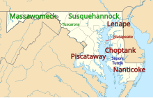
By 1000 AD, there were about 8,000 Native Americans, all Algonquian-speaking, living in what is now the state, in 40 different villages. By the 17th century, the state was populated by a mix of Iroquoian and Algonquian peoples. These were the Susquehannocks (west of the Delaware River), the Tuscarora and Tockwogh (on the Delmarva Peninsula between the Delaware and Indian Rivers), the Piscataway (surrounding the Potomac River from Washington D.C. south) and the Nanticoke (Delmarva Peninsula, south of the Indian River). John Smith labelled the Tuscarora as the Kuskarawock on an early map from 1606, but they shortly thereafter moved west to join the Meherrin and Nottoway in Virginia.[5] Meanwhile, the Tockwogh may have moved to New York and/or been given refuge by the Susquehannock. They are noted as the Akhrakovaetonon and Trakwaerronnons, which seems similar to Tockwogh. They were extinct as a people by the end of the 17th century, however.[6]
The following Piscataway tribes lived on the eastern bank of the Potomac, from south to north: Yaocomicoes, Chopticans, Nanjemoys, Potopacs, Mattawomans, Piscataways, Patuxents, and Nacotchtanks. The area in which the Nacotchtank lived is now the District of Columbia. On the west bank of the Potomac river in what is now Virginia were the related tribes of the Patawomeck and the Doeg. Further west in the Appalachian Mountains, the Shawnee lived near Oldtown at a site abandoned around 1731. On the Eastern Shore of the Chesapeake, from south to north, there were the Nanticoke tribes: Annemessex, Assateagues, Wicomicoes, Nanticokes, Chicacone, and, on the north bank of the Choptank River, the Choptanks. The Tockwogh tribe lived near the headwaters of the Chesapeake near what is now Delaware.[7] They were driven further north by enemies and eventually broke apart, with some staying in the region, others merging with the Nanticoke and others, known as the Conoy, migrated west into West Virginia.[8] Some appeared around the end of the 18th century at Fort Detroit in Michigan.
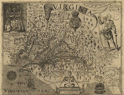
When Europeans began to settle in Maryland in the early 17th century, the main tribes included the Nanticoke on the Eastern Shore, and the Iroquoian speaking Susquehannock. Early exposure to new European diseases brought widespread fatalities to the Native Americans, as they had no immunity to them. Communities were disrupted by such losses. Furthermore, The Susquehannock, already incorrectly considered savages and cannibals by the first Spanish explorers, made massive moves to control local trade with the first Swedish, Dutch and English settlers of the Chesapeake Bay region. As the century wore on, the Susquehannock would be caught up in the Beaver Wars, a war with the neighboring Lenape, a war with the Dutch, a war with the English, and a series of wars with the colonial government of Maryland. Due to colonial land claims, the exact territory of the Susquehannock was originally limited to the territory immediately surrounding the Susquehanna River, however archaeology has discovered settlements of theirs dating to the 14th and 15th centuries around the Maryland-West Virginia border, and beyond. It could generally be assumed that most of Maryland's southern border is based on the borders of their own land. All of these wars, coupled with disease, destroyed the tribe and the last of their people were offered refuge from the Iroquois Confederacy to the north shortly thereafter.[9]
The closest living language to them are the languages of the Mohawk and Tuscarora Iroquois, who once lived immediately north and south of them. The English and Dutch came to call them the Minqua, from Lenape, which breaks into min-kwe and translates to "as a woman." As to when they arrived, some early records detailing their oral history seem to point to the fact that they descended from an Iroquoian group who conquered Ohio centuries before, but were pushed back east again by Siouan and Algonquin enemies. They also conquered and absorbed other unknown groups in the process, which probably explains how languages like Tuscarora came to be so completely divergent from other Iroquoian languages. It also appears possible that the word "Iroquois" actually derived from their language.[10][11]
The Nanticoke seem to have been largely confined to Indian Towns,[12] but were later relocated to New York in 1778. Afterwards, they dissolved, with groups joining the Iroquois and Lenape.[13][14]
Also, as Susquehannocks began to abandon much of their westernmost territory due to their own hardships, a group of Powhatan split off, becoming known as the Shawnee and migrated into the western regions of Maryland and Pennsylvania briefly before moving on.[15] At the time, they were relatively small, but they eventually made the Ohio River, migrating all the way into Ohio and merged with other nations there to become the powerful, military force that they were known to be during the 18th and 19th centuries.
Early European exploration
[edit]In 1498 the first European explorers sailed along the Eastern Shore, off present-day Worcester County.[16] In 1524 Giovanni da Verrazzano, sailing under the French flag, passed the mouth of Chesapeake Bay. In 1608 John Smith entered the bay[16] and explored it extensively. His maps have been preserved to today. Although technically crude, they are surprisingly accurate given the technology of those times (the maps are ornate but crude by modern technical standards).
The region was depicted in an earlier map by Estêvão Gomes and Diego Gutiérrez, made in 1562, in the context of the Spanish Ajacán Mission of the sixteenth century.[17]
Colonial Maryland
[edit]
Establishment
[edit]George Calvert, 1st Baron Baltimore, applied to Charles I for a royal charter for what was to become the Province of Maryland. After Calvert died in April 1632, the charter for "Maryland Colony" (in Latin Terra Mariae) was granted to his son, Cecilius Calvert, 2nd Baron Baltimore, on June 20, 1632.[18] Some historians viewed this as compensation for his father having been stripped of his title of Secretary of State in 1625 after announcing his Roman Catholicism.
Officially the colony is said to be named in honor of Queen Henrietta Maria, the wife of King Charles I.[19] Some Catholic scholars believe that George Calvert named the province after Mary, the mother of Jesus.[20] The name in the charter was phrased Terra Mariae, anglice, Maryland. The English name was preferred due to the undesired associations of Mariae with the Spanish Jesuit Juan de Mariana, linked to the Inquisition.[21]

As did other colonies, Maryland used the headright system to encourage people to bring in new settlers. Led by Leonard Calvert, Cecil Calvert's younger brother, the first settlers departed from Cowes, on the Isle of Wight, on November 22, 1633, aboard two small ships, the Ark and the Dove. Their landing on March 25, 1634, at St. Clement's Island in southern Maryland is commemorated by the state each year on that date as Maryland Day. This was the site of the first Catholic mass in the Colonies, with Father Andrew White leading the service. The first group of colonists consisted of 17 gentlemen and their wives, and about two hundred others, mostly indentured servants.[24]
After purchasing land from the Yaocomico Indians and establishing the town of St. Mary's, Leonard, per his brother's instructions, attempted to govern the country under feudalistic precepts. Meeting resistance, in February 1635, he summoned a colonial assembly. In 1638, the Assembly forced him to govern according to the laws of England. The right to initiate legislation passed to the assembly.
In 1638 Calvert seized a trading post in Kent Island established by the Virginian William Claiborne. In 1644 Claiborne led an uprising of Maryland Protestants. Calvert was forced to flee to Virginia, but he returned at the head of an armed force in 1646 and reasserted proprietarial rule.

Maryland soon became one of the few predominantly Catholic regions among the English colonies in North America. Maryland was also one of the key destinations where the government sent tens of thousands of English convicts punished by sentences of transportation. Such punishment persisted until the Revolutionary War.
The Maryland Toleration Act, issued in 1649, was one of the first laws that explicitly defined tolerance of varieties of Christianity.
Protestant revolts
[edit]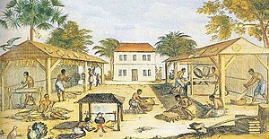
St. Mary's City was the largest settlement in Maryland and the seat of colonial government until 1695. Because Anglicanism had become the official religion in Virginia, a band of Puritans in 1649 left for Maryland; they founded Providence (now called Annapolis).[25] In 1650 the Puritans revolted against the proprietary government. They set up a new government prohibiting both Catholicism and Anglicanism. In March 1655, the 2nd Baron Baltimore sent an army under Governor William Stone to put down this revolt. Near Annapolis, his Roman Catholic army was decisively defeated by a Puritan army in the Battle of the Severn. The Puritan Revolt lasted until 1658, when the Calvert family regained control and re-enacted the Toleration Act.[26]
In 1689, following the accession of a Protestant monarchy in England, rebels against the Catholic regime in Maryland overthrew the government and took power. Lord Baltimore was stripped of his right to govern the province, though not of his territorial rights. Maryland was designated as a royal province, administered by the crown via appointed governors until 1715. At that time, Benedict Calvert, 4th Baron Baltimore, having converted to Anglicanism, was restored to proprietorship.[27]
The Protestant revolutionary government persecuted Maryland Catholics during its reign. Mobs burned down all the original Catholic churches of southern Maryland. The Anglican Church was made the established church of the colony. In 1695 the royal Governor, Francis Nicholson, moved the seat of government to Ann Arundell Town in Anne Arundel County and renamed it Annapolis in honor of the Princess Anne, who later became Queen Anne of Great Britain.[28] Annapolis remains the capital of Maryland. St. Mary's City is now an archaeological site, with a small tourist center.
Just as the city plan for St. Mary's City reflected the ideals of the founders, the city plan of Annapolis reflected those in power at the turn of the 18th century. The plan of Annapolis extends from two circles at the center of the city – one including the State House and the other the established Anglican St. Anne's Church (now Episcopal). The plan reflected a stronger relationship between church and state, and a colonial government more closely aligned with Protestant churches. General British policy regarding immigration to all British America would be reflected broadly in the Plantation Act of 1740.
Mason–Dixon Line
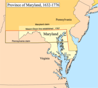
[edit]Based on an incorrect map, the original royal charter granted to Maryland the Potomac River and territory northward to the fortieth parallel. This was found to be a problem, as the northern boundary would have put Philadelphia, the major city in Pennsylvania, within Maryland. The Calvert family, which controlled Maryland, and the Penn family, which controlled Pennsylvania, decided in 1750 to engage two surveyors, Charles Mason and Jeremiah Dixon, to establish a boundary between the colonies.
They surveyed what became known as the Mason–Dixon Line, which became the boundary between the two colonies. The crests of the Penn family and of the Calvert family were put at the Mason–Dixon line to mark it.[29]
Horse racing and gentry values
[edit]In Chesapeake society (that is, colonial Virginia and Maryland) sports occupied a great deal of attention at every social level. Horse racing was sponsored by the wealthy gentry plantation owners, and attracted ordinary farmers as spectators and gamblers. Selected slaves often became skilled horse trainers. Horse racing was especially important for knitting the gentry together. The race was a major public event designed to demonstrate to the world the superior social status of the gentry through expensive breeding and training of horses, boasting and gambling, and especially winning the races themselves.[30] Historian Timothy Breen explains that horseracing and high-stakes gambling were essential to maintaining the status of the gentry. When they publicly bet a large fraction of their wealth on their favorite horse, they expressed competitiveness, individualism, and materialism as the core elements of gentry values.[31]
The Revolutionary period
[edit]Maryland did not at first favor independence from Great Britain and gave instructions to that effect to its delegates to the Second Continental Congress. During this initial phase of the Revolutionary period, Maryland was governed by a series of conventions of the Assembly of Freemen. The first convention of the Assembly lasted four days, from June 22 to 25, 1774. All sixteen counties then existing were represented by a total of 92 members; Matthew Tilghman was elected chairman.[citation needed]

The eighth session decided that the continuation of an ad hoc government by the convention was not a good mechanism for all the concerns of the province. A more permanent and structured government was needed. So, on July 3, 1776, they resolved that a new convention be elected that would be responsible for drawing up their first state constitution, one that did not refer to parliament or the king, but would be a government "...of the people only." After they set dates and prepared notices to the counties they adjourned. On August 1, all freemen with property elected delegates for the last convention. The ninth and last convention was also known as the Constitutional Convention of 1776. They drafted a constitution, and when they adjourned on November 11, they would not meet again. The conventions were replaced by the new state government which the Maryland Constitution of 1776 had established. Thomas Johnson became the state's first elected governor.[citation needed]
On March 1, 1781, the Articles of Confederation and Perpetual Union was ratified and took effect with the confirmation signing of the Articles by two Maryland delegates in Philadelphia. The articles had initially been submitted to the states on November 17, 1777, but the ratification process dragged on for several years, stalled by an interstate quarrel over claims to uncolonized land in the west of the Appalachian Mountains to the Mississippi River. Maryland was the last hold-out; it refused to ratify until larger states like Virginia and New York agreed to rescind their claims to lands in what became the old Northwest Territory and the Southwest Territory. Chevalier de La Luzerne, French Minister to the United States, felt that the Articles would help strengthen the American government. In 1780 when Maryland requested France provide naval forces in the Chesapeake Bay for protection from the British (who were conducting raids in the lower part of the bay), he indicated that French Admiral Destouches would do what he could but La Luzerne also "sharply pressed" Maryland to ratify the Articles, thus suggesting the two issues were related.[32] On February 2, 1781, the much-awaited decision was taken by the Maryland General Assembly in Annapolis.[33] As the last piece of business during the afternoon Session, "among engrossed Bills" was "signed and sealed by Governor Thomas Sim Lee in the Senate Chamber, in the presence of the members of both Houses... an Act to empower the delegates of this state in Congress to subscribe and ratify the articles of confederation" and perpetual union among the states. The Senate then adjourned "to the first Monday in August next." The decision of Maryland to ratify the Articles was reported to the Continental Congress on February 12, 1781.

No significant battles of the American Revolutionary War (1775–1783) occurred in Maryland. However, this did not prevent the state's soldiers from distinguishing themselves through their service. General George Washington was impressed with the Maryland regulars (the "Maryland Line") who fought in the Continental Army and, according to one tradition, this led him to bestow the name "Old Line State" on Maryland.[19] Today, the Old Line State is one of Maryland's two official nicknames.[34]
The Second Continental Congress met briefly in Baltimore from December 20, 1776, through March 4, 1777 at the old hotel, later renamed Congress Hall, at the southwest corner of West Market Street (now Baltimore Street) and Sharp Street/Liberty Street. Marylander John Hanson, served as President of the Continental Congress from 1781 to 1782. Hanson was the first person to serve a full term with the title of "President of the United States in Congress Assembled" under the Articles of Confederation and Perpetual Union.[citation needed]
Annapolis served as the temporary United States capital from November 26, 1783, to June 3, 1784, and the Confederation Congress met in the recently completed Maryland State House. Annapolis was a candidate to become the new nation's permanent capital before the site along the Potomac River was selected for the District of the Columbia. It was in the old Senate chamber[19] that General George Washington famously resigned his commission as commander in chief of the Continental Army on December 23, 1783. It was also there that the Treaty of Paris of 1783, which ended the Revolutionary War, was ratified by Congress on January 14, 1784.[citation needed]
Major General William Smallwood, having served under General George Washington during the Revolutionary War, then Commander-in-Chief of the Continental Army, became the fourth American Governor of Maryland. In 1787, Governor William Smallwood called together and convened the state convention to decide whether to ratify the proposed U.S. Constitution in 1788. The majority of the votes at the convention were in favor of ratification, and Maryland became the seventh state to ratify the Constitution.[citation needed]
Maryland, 1789–1849
[edit]Economic development
[edit]The American Revolution stimulated the domestic market for wheat and iron ore, and flour milling increased in Baltimore. Iron ore transport greatly boosted the local economy. By 1800 Baltimore had become one of the major cities of the new republic. The British naval blockade during the War of 1812 hurt Baltimore's shipping, but also freed merchants and traders from British debts, which along with the capture of British merchant vessels furthered the city's economic growth.
Transportation initiatives
[edit]The city had a deepwater port. In the early 19th century, many business leaders in Maryland were looking inland, toward the western frontier, for economic growth potential. The challenge was to devise a reliable means to transport goods and people. The National Road and private turnpikes were being completed throughout the state, but additional routes and capacity were needed. Following the success of the Erie Canal (constructed 1817–25) and similar canals in the northeastern states, leaders in Maryland were also developing plans for canals. After several failed canal projects in the Washington, D.C. area, the Chesapeake and Ohio Canal (C&O) began construction there in 1828. The Baltimore business community viewed this project as a competitive threat. The geography of the Baltimore area made building a similar canal to the west impractical, but the idea of constructing railroads was beginning to gather support in the 1820s.
In 1827 city leaders obtained a charter from the Maryland General Assembly to build a railroad to the Ohio River.[35]: 17 The Baltimore and Ohio Railroad (B&O) became the first chartered railroad in the United States, and opened its first section of track for regular operation in 1830, between Baltimore and Ellicott City.[36]: 80 It became the first company to operate a locomotive built in America, with the Tom Thumb.[37] The B&O built a branch line to Washington, D.C. in 1835.[36]: 184 The main line west reached Cumberland in 1842, beating the C&O Canal there by eight years, and the railroad continued building westward.[35]: 54 In 1852 it became the first rail line to reach the Ohio River from the eastern seaboard.[35]: 18 Other railroads were built in and through Baltimore by mid-century, most significantly the Northern Central; the Philadelphia, Wilmington and Baltimore; and the Baltimore and Potomac. (All of these came under the control of the Pennsylvania Railroad.)
Industrial Revolution
[edit]Baltimore's seaport and good railroad connections fostered substantial growth during the Industrial Revolution of the 19th century. Many manufacturing businesses were established in Baltimore and the surrounding area after the Civil War.
Cumberland was Maryland's second largest city in the 19th century, with ample nearby supplies of coal, iron ore and timber. These resources, along with railroads, the National Road and the C&O Canal, fostered its growth. The city was a major manufacturing center, with industries in glass, breweries, fabrics and tinplate.
The Pennsylvania Steel Company founded a steel mill at Sparrow's Point in Baltimore in 1887. The mill was purchased by Bethlehem Steel in 1916, and it became the world's largest steel mill by the mid-20th century, employing tens of thousands of workers.[38]
Educational institutions
[edit]In 1807, the College of Medicine of Maryland (later the University of Maryland Medical School) became the seventh medical school in the United States.[39]
In 1840, by order of the Maryland state legislature, the non-religious St. Mary's Female Seminary was founded in St. Mary's City. This would later become St. Mary's College of Maryland, the state's public honors college. The United States Naval Academy was founded in Annapolis in 1845, and the Maryland Agricultural College was chartered in 1856, growing eventually into the University of Maryland.
Immigration and religion
[edit]Since the abolition of anti-Catholic laws[citation needed] in the early 1830s, the Catholic population rebounded considerably. The Maryland Catholic population began its resurgence with large waves of Irish Catholic immigration spurred by the Great Famine (1845–49) and then continued through the first half of the 20th century.[40] Italian immigration[41] and Polish immigrations also supplemented the Catholic population in Maryland.[41] Baltimore was the third largest point of entry for European immigrants on the Eastern seaboard for much of this period.[40] Although greatly increased, the Catholic population has never become a majority in the state.
War of 1812
[edit]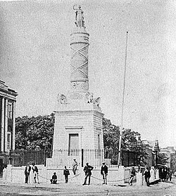
After the Revolution, the United States Congress approved construction of six heavy frigates to form a nucleus of the United States Navy. One of the first three, the USS Constellation, was constructed in Baltimore. Constellation became the first official U.S. Navy ship put to sea, deploying to the Caribbean Sea to participate in the Quasi-War against France.
During the War of 1812 the British raided cities along Chesapeake Bay up to Havre de Grace. Two notable battles occurred in the state. The first was the Battle of Bladensburg on August 24, 1814, just outside the national capital, Washington, D.C. The British army routed the American militiamen, who fled in confusion, and went on to capture Washington, D.C. They burned and looted major public buildings, forcing President James Madison to flee to Brookeville, Maryland.[citation needed]
The British next marched to Baltimore, where they hoped to strike a knockout blow against the demoralized Americans. Baltimore was not only a busy port but also suspected of harboring many of the privateers despoiling British ships. The city's defenses were under the command of Major General Samuel Smith, an officer and commander of the Maryland state militia and a United States senator. Baltimore had been well fortified with excellent supplies and some 15,000 troops. Maryland militia fought a determined delaying action at the Battle of North Point, during which a Maryland militia marksman shot and killed the British commander, Major General Robert Ross. The battle bought enough time for Baltimore's defenses to be strengthened.
After advancing to the edge of American defenses, the British halted their advance and withdrew. With the failure of the land advance, the sea battle became irrelevant and the British retreated. At Fort McHenry, some 1000 soldiers under the command of Major George Armistead awaited the British naval bombardment. Their defense was augmented by the sinking of a line of American merchant ships at the adjacent entrance to Baltimore Harbor to thwart passage of British ships. The attack began on the morning of September 13, as the British fleet of some nineteen ships began pounding the fort with rockets and mortar shells. After an initial exchange of fire, the British fleet withdrew just beyond the 1.5 miles (2.4 km) range of Fort McHenry's cannons. For the next 25 hours, they bombarded the outmanned Americans. On the morning of September 14, an oversized American flag, which had been raised before daybreak, flew over Fort McHenry. The British knew that victory had eluded them. The bombardment of the fort inspired Francis Scott Key of Frederick, Maryland to write "The Star-Spangled Banner" as witness to the assault. It later became the country's national anthem.
American Civil War
[edit]Maryland's mixed sympathies
[edit]
Maryland was a border state, straddling the North and South. As in Virginia and Delaware, some planters in Maryland had freed their slaves in the years after the Revolutionary War. By 1860 Maryland's free black population comprised 49.1% of the total of African Americans in the state.[4]
After John Brown's raid in 1859 on Harper's Ferry, Virginia, some citizens in slaveholding areas began forming local militias for defense. Of the 1860 population of 687,000, about 60,000 Marylanders joined the Union and about 25,000 fought for the Confederacy. The political alignments of each group generally reflected their economic interests, with slaveholders and people involved in trade with the South most likely to favor the Confederate cause, and small farmers and merchants outside the major cities and in western Maryland allied with the Union. In the 1860 election, Lincoln received only one vote in Prince George's County, a center of large plantations.[42]
Beginning of the war
[edit]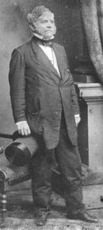
The first bloodshed of the war occurred in Baltimore when the 6th Massachusetts Militia battled an attacking mob while marching between railroad stations on April 19, 1861. After that, Baltimore Mayor George William Brown, Marshal George P. Kane, and former Governor Enoch Louis Lowe requested that Maryland Governor Thomas H. Hicks, a slave owner from the Eastern Shore, burn the railroad bridges and cut the telegraph lines leading to Baltimore to prevent further troops from entering the state. Hicks reportedly approved this proposal. These actions were addressed in the famous federal court case of Ex parte Merryman.[citation needed]
Maryland remained part of the Union during the Civil War. President Abraham Lincoln's strong hand suppressing violence and dissent in Maryland and the belated assistance of Governor Hicks played important roles. Hicks worked with federal officials to stop further violence.
Lincoln promised to avoid having Northern defenders march through Baltimore while en route to protect the acutely endangered federal capital. The majority of forces took a slow route by boat. Massachusetts militia general Benjamin F. Butler used the water route after learning about the troubles in Baltimore. He commandeered the P. W. & B. Railroad ferryboat Harriet Lane at the Susquehanna River crossing between Perryville in Cecil County to Havre de Grace in Harford County. Avoiding the riotous city, he steamed down the Chesapeake Bay to anchor at night off the Naval Academy at Severn Point in Annapolis.[citation needed]
He landed his troops of Massachusetts, New York and Rhode Island militia over the protests of Governor Thomas Holliday Hicks (1798–1865). He put some on the old Navy training ship frigate, USS Constitution ("Old Ironsides") and moved it off shore beyond reach of easy attack. Recruiting some railroad workers and boilermakers among his soldiers, Butler had them rescue a small yard locomotive in the trainyards and use it to take cars full of soldiers up the Annapolis Line of the B&O Railroad to Relay Junction near Ellicott City, where it joined the Main Line going west to Harpers Ferry, West Virginia or south to Washington.[citation needed] The Northern regiments used this route to reach the train station, now Washington Union Station near the U.S. Capitol). They camped that evening in the Rotunda, which was not yet completed. An additional unit was sent up Pennsylvania Avenue to reinforce the White House, where the president greeted them with relief.[citation needed]
Marylanders sympathetic to the South easily crossed the Potomac River to join and fight for the Confederacy. Exiles organized a "Maryland Line" in the Army of Northern Virginia which consisted of one infantry regiment, one infantry battalion, two cavalry battalions and four battalions of artillery. According to the best extant records, up to 25,000 Marylanders went south to fight for the Confederacy.[citation needed] About 60,000 Marylanders served in all branches of the Union military. Many of the Union troops were said to enlist on the promise of home garrison duty.[citation needed]
Maryland's naval contribution, the relatively new sloop-of-war USS Constellation was flagship of the US Africa Squadron from 1859 to 1861 and continued in this role during the war. In this period, she disrupted the African slave trade by interdicting three slave ships and releasing the imprisoned slaves. The last of the ships was captured at the outbreak of the Civil War: Constellation overpowered the slaver brig Triton in African coastal waters. Constellation spent much of the war as a deterrent to Confederate cruisers and commerce raiders in the Mediterranean Sea.[citation needed]
Occupation of Baltimore
[edit]A Union artillery garrison was placed on Federal Hill with express orders to destroy the city should Southern sympathizers overwhelm law and order there.[43] Following the riot of 1861, Union troops under the command of General Benjamin F. Butler occupied the hill in the middle of the night. Butler and his troops erected a small fort, with cannon pointing towards the central business district. Their goal was to guarantee the allegiance of the city and the state of Maryland to the federal government under threat of force. This fort and the Union occupation persisted for the duration of the Civil War. A large flag, a few cannon, and a small Grand Army of the Republic monument remain to testify to this period of the hill's history.
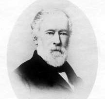
Because Maryland remained in the Union, it fell outside the scope of the Emancipation Proclamation. A constitutional convention in 1864 culminated in the passage of a new state constitution on November 1 of that year. Article 24 of that document outlawed the practice of slavery. A campaign by state politician John Pendleton Kennedy and others ensured that abolishment of slavery would be in the new document, and the issue was hotly contested for nearly a year throughout the state. In the end the elimination of slavery was approved by a 1,000-vote margin. The right to vote was extended to non-white males in the Maryland Constitution of 1867, which is still in effect today.
The war on Maryland soil
[edit]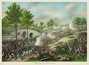
The largest and most significant battle fought in the state was the Battle of Antietam, fought on September 17, 1862, near Sharpsburg. The battle was the culmination of Robert E. Lee's Maryland Campaign, which aimed to secure new supplies, recruit fresh soldiers from among the considerable pockets of Confederate sympathies in Maryland, and to impact public opinion in the North. With those goals, Lee's Army of Northern Virginia, consisting of about 40,000 men, had entered Maryland following their recent victory at Second Bull Run.
While Major General George B. McClellan's 87,000-man Army of the Potomac was moving to intercept Lee, a Union soldier discovered a mislaid copy of the detailed battle plans of Lee's army. The order indicated that Lee had divided his army and dispersed portions geographically (to Harpers Ferry, West Virginia, and Hagerstown, Maryland), thus making each subject to isolation and defeat in detail if McClellan could move quickly enough. McClellan waited about 18 hours before deciding to take advantage of this intelligence and position his forces based on it, thus endangering a golden opportunity to defeat Lee decisively.
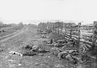
The armies met near the town of Sharpsburg by Antietam Creek. Although McClellan arrived in the area on September 16, his trademark caution delayed his attack on Lee, which gave the Confederates more time to prepare defensive positions and allowed Longstreet's corps to arrive from Hagerstown and Jackson's corps, minus A. P. Hill's division, to arrive from Harpers Ferry. McClellan's two-to-one advantage in the battle was almost completely nullified by a lack of coordination and concentration of Union forces, which allowed Lee to shift his defensive forces to parry each thrust.
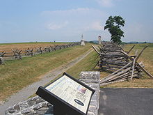
Although a tactical draw, the Battle of Antietam was considered a strategic Union victory and a turning point of the war. It forced the end of Lee's invasion of the North. It also was enough of a victory to enable President Lincoln to issue the Emancipation Proclamation, which took effect on January 1, 1863. He had been advised by his Cabinet to make the announcement after a Union victory, to avoid any perception that it was issued out of desperation. The Union's winning the Battle of Antietam also may have dissuaded the governments of France and Great Britain from recognizing the Confederacy. Some observers believed they might have done so in the aftermath of another Union defeat.
Maryland, 1865–1920
[edit]Post-Civil War political developments
[edit]Since Maryland had remained in the Union during the Civil War, the state was not covered by the Reconstruction Act, as were states of the former Confederacy. After the war, many white Maryland residents struggled to re-establish white supremacy over freedmen and formerly free blacks, and racial tensions rose. There were deep divisions in the state between those who fought for the North and those who fought for the South.
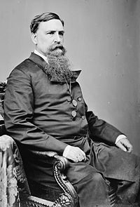
In the late 1860s, the white males of the Democratic Party rapidly regained power in the state and replaced Republicans who had been elected or appointed during the war. Support for the Constitution of 1864 ended, and Democrats replaced it with the Maryland Constitution of 1867. That document, which is still in effect today, resembled the 1851 constitution more than its immediate predecessor and was approved by 54.1% of the state's male population. It provided for the reapportionment of the legislature based on population, not counties, which gave greater political power to more dense urban areas (and, by extension, to freedmen), but the new constitution deprived African Americans of some of the protections of the 1864 document.

In 1896, a biracial Republican coalition gained election of Lloyd Lowndes, Jr. as governor, and also achieved election of some Republican congressmen, including Sydney Emanuel Mudd, after Democratic dominance.[44] Over the next several decades, the African-American population struggled in a discriminatory environment. The Democrat-dominated male legislature tried to pass disfranchising bills in 1905, 1907, and 1911, but was rebuffed on each occasion, in large part because of black opposition and strength. Black men comprised 20% of the electorate and had established themselves in several cities, where they had comparative security. In addition, immigrant men comprised 15% of the voting population and opposed these measures. The legislature had difficulty devising requirements against blacks that did not also disadvantage immigrants.[44]
In 1910, the legislature proposed the Digges Amendment to the state constitution. It would have used property requirements to effectively disfranchise many African American men as well as many poor white men (including new immigrants), a technique used by other southern states from 1890 to 1910, beginning with Mississippi's new constitution. The Maryland General Assembly passed the bill, which Governor Austin Lane Crothers supported. Before the measure went to popular vote, a bill was proposed that would have effectively passed the requirements of the Digges Amendment into law. Due to widespread public opposition, that measure failed, and the amendment was also rejected by the voters of Maryland.
Nationally Maryland citizens achieved the most notable rejection of a black-disfranchising amendment.[44] Similar measures had earlier been proposed in Maryland, but also failed to pass (the Poe Amendment in 1905 and the Straus Amendment in 1909). The power of black men at the ballot box and economically helped them resist these bills and disfranchising effort.[44]
Businessmen Johns Hopkins, Enoch Pratt, George Peabody, and Henry Walters were philanthropists of 19th century Baltimore; they founded notable educational, health care, and cultural institutions in that city. Bearing their names, these include a university, free city library, music and art school, and art museum.
Progressive era reforms
[edit]In the early 20th century, a political reform movement arose, centered in the rising new middle class. One of their main goals included having government jobs granted on the basis of merit rather than patronage. Other changes aimed to reduce the power of political bosses and machines, which they succeeded in doing.
In a series of laws passed between 1892 and 1908, reformers worked for standard state-issued ballots (rather than those distributed and pre-marked by the parties); obtained closed voting booths to prevent party workers from "assisting" voters; initiated primary elections to keep party bosses from selecting candidates; and had candidates listed without party symbols, which discouraged the illiterate from participating. Although promoted as democratic reforms, the changes had other results sought by the middle class. They discouraged participation by the lower classes and illiterate voters. Voting participation dropped from about 82% of eligible voters in the 1890s to about 49% in the 1920s.
Other laws regulated working conditions. For instance, in a series of laws passed in 1902, the state regulated conditions in mines; outlawed child laborers under the age of 12; mandated compulsory school attendance; and enacted the nation's first workers' compensation law.[citation needed] The workers' compensation law was overturned in the courts, but was redrafted and finally enacted in 1910. The law become a model for national legislation a few decades later.[citation needed]
The debate over prohibition of alcohol, another progressive reform, led to Maryland's gaining its second nickname. A mocking newspaper editorial dubbed Maryland "the Free State" for its allowing alcohol.[19][34]
Great Baltimore Fire
[edit]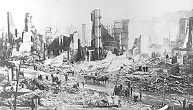
The Great Baltimore Fire of 1904 was a momentous event for Maryland's largest city and the state as a whole. The fire raged in Baltimore from 10:48 am. Sunday, February 7, to 5:00 pm. Monday, February 8, 1904. More than 1,231 firefighters worked to bring the blaze under control.
One reason for the fire's duration was the lack of national standards in fire-fighting equipment. Although fire engines from nearby cities (such as Philadelphia and Washington, as well as units from New York City, Wilmington, and Atlantic City) responded, many were useless because their hose couples failed to fit Baltimore hydrants. As a result, the fire burned over 30 hours, destroying 1,526 buildings and spanning 70 city blocks.
In the aftermath, 35,000 people were left unemployed. After the fire, the city was rebuilt using more fireproof materials, such as granite pavers.
The World War I era
[edit]Entry into World War I brought changes to Maryland.
Maryland was the site of new military bases, such as Camp Meade (now Fort Meade), the Aberdeen Proving Ground, which were established in 1917, and the Edgewood Arsenal, which was founded the following year. Other existing facilities, including Fort McHenry, were greatly expanded.
To coordinate wartime activities, like the expansion of federal facilities, the General Assembly set up a Council of Defense. The 126 seats on the council were filled by appointment.[clarification needed] The council, which had a virtually unlimited budget, was charged with defending the state, supervising the draft, maintaining wage and price controls, providing housing for war-related industries, and promoting support for the war. Citizens were encouraged to grow their own victory gardens and to obey ration laws. They were also forced to work, once the legislature adopted a compulsory labor law with the support of the Council of Defense.
Culture
[edit]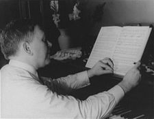
H. L. Mencken (1880–1956) was the state's iconoclastic writer and intellectual trendsetter. In 1922 the "Sage of Baltimore" praised the state for its "singular and various beauty from the stately estuaries of the Chesapeake to the peaks of the Blue Ridge." He happily reported that Providence had spared Maryland the harsh weather, the decay, the intractable social problems of other states. Statistically, Maryland held tightly to the middle ground– in population, value of manufacturers, percentage of native whites, the proportion of Catholics, the first and last annual frost. Everywhere he looked he found Maryland in the middle. In national politics it worked sometimes with the northern Republicans, other times with southern Democrats. This average quality perhaps represented a national ideal toward which other states were striving. Nevertheless, Mencken sensed something was wrong. "Men are ironed out. Ideas are suspect. No one appears to be happy. Life is dull."[45]
Maryland, early to mid-20th century
[edit]The Ritchie administration
[edit]
In 1918, Maryland elected Albert C. Ritchie, a Democrat, governor. He was reelected four times, serving from 1919 to 1934. Ritchie was handsome, aristocratic, and very pro-business. He hired a management firm to streamline government operations and established a budget process controlled largely by economists. He also won approval for a civil service system, long been sought by reformers who wanted positions given on the basis of merit and not patronage; reduced the number of state elections by extending legislative terms from two to four years; and appointed citizens' commissions to advise on nearly every aspect of government. State property taxes dropped sharply under Ritchie, but so did state services. A powerful movie censorship board kept subversive ideas away from the masses. Three times, including 1924 and 1932, Ritchie was a candidate for President of the United States, arguing that Presidents Coolidge and Hoover were hopeless spendthrifts.[46] Ritchie lost his bid for the Democratic Party's nomination for president in 1932. Despite a large demonstration of support at the convention, Franklin D. Roosevelt was nominated and went on to win the election. Ritchie continued to serve as governor until 1935.[47]
The Great Depression and World War II
[edit]Maryland's urban and rural communities had different experiences during the Depression. In 1932 the "Bonus Army" marched through the state on its way to Washington, D.C. In addition to the nationwide New Deal reforms of President Roosevelt, which put people to work building roads and park facilities, Maryland also took steps to weather the hard times. For instance, in 1937 the state instituted its first ever income tax to generate revenue for schools and welfare.[citation needed]
The state had some advances in civil rights. The 1935 case Murray v. Pearson et al. resulted in a Baltimore City Court's ordering integration of University of Maryland Law School. The plaintiff in that case was represented by Thurgood Marshall, a young lawyer with the NAACP and a native of Baltimore. When the state attorney general appealed to the Court of Appeals, it affirmed the decision. Because the state did not appeal the ruling in the federal courts, this state ruling under the U.S. Constitution was the first to overturn Plessy v. Ferguson, the 1896 Supreme Court decision that allowed separate but equal facilities.[citation needed] While the ruling was a moral precedent, it had no authority outside the state of Maryland.
A hurricane in 1933 created an inlet in Sinepuxent Bay at Ocean City, making the then-small town attractive for recreational fishing. During World War II additional large defense facilities were established in the state such as Andrews Air Force Base, Patuxent River Naval Air Station, and the large Glenn L. Martin aircraft factory east of Baltimore.
Mid-20th century
[edit]In 1952, the eastern and western halves of Maryland were linked for the first time by the long Chesapeake Bay Bridge, which replaced a nearby ferry service.[48] This bridge (and its later, parallel span) increased tourist traffic to Ocean City, which experienced a building boom. Soon after, the Baltimore Harbor Tunnel allowed long-distance interstate motorists to bypass downtown Baltimore, while the earlier Harry W. Nice Memorial Bridge allowed them to bypass Washington, D.C. Two beltways, I-695 and I-495, were built around Baltimore and Washington, while I-70, I-270, and later I-68 linked central Maryland with western Maryland, and I-97 linked Baltimore with Annapolis. Passenger and freight steamboat transportation, previously very important throughout the Chesapeake Bay and its many tributaries, came to an end in mid-century.
Maryland, late 20th century to present
[edit]In 1980, the opening of Harborplace and the Baltimore Aquarium made that city a significant tourist destination, while Charles Center, the World Trade Center, and the popular Camden Yards baseball stadium were constructed in the downtown area. Fells Point also became popular. The historic Annapolis waterfront area, previously a working-class fishing port,[citation needed] also became gentrified[citation needed] and a tourist destination. Baltimore's largest employer, the Bethlehem Steel factory at Sparrows Point, shrunk, and the General Motors plant closed, while Johns Hopkins University and Health Care System took Bethlehem's place as Baltimore's largest employer. There are over 350 biotechnology companies in the state.[49] The Social Security – Health Care Financing Administration, Bureau of Standards, U.S. Census Bureau, National Institutes of Health, National Security Agency, and Public Health Service have their headquarters in the state. Metrorail lines were constructed in Montgomery and Prince George's counties, while Baltimore opened its own 20 miles (32 km) Metro Subway as well as the north–south Baltimore Light Rail system.
In addition to general suburban growth, specially planned new communities sprung up, most notably Columbia, but also Montgomery Village, Belair at Bowie, St. Charles, Cross Keys, and Joppatowne, and numerous shopping malls, the state's three largest malls being Annapolis Mall, Arundel Mills and the Towson Town Center. Community colleges were established in nearly every county in Maryland. Large-scale, mechanized poultry farms became prevalent on the lower Eastern Shore, along with irrigated vegetable farming. In Southern Maryland tobacco farming had nearly vanished by the century's end, due to suburban housing development and a state tobacco incentive buy-out program. Industrial, railroad, and coal-mining jobs in the four westernmost counties declined, but that area's economy was helped by expansion of outdoor recreational tourism and new technology jobs and industries.[citation needed] From the beginning of the 21st century, Maryland joined neighboring states in a new initiative to save the health of Chesapeake Bay, whose aquatic life and seafood industry are threatened by waterfront residential development, as well as by fertilizer and livestock waste entering the bay, especially from Pennsylvania's Susquehanna River.[50][51] In addition, about 580 acres (230 ha) of Maryland shore are eroded per year due to the land sinking and rising sea levels.[52] In 2013, Maryland abolished capital punishment.
Key Bridge collapse
[edit]
On March 26, 2024, the Francis Scott Key Bridge in Baltimore collapsed after the container ship Dali collided with it.[53] The collapse caused the death of 6 construction workers.[53]
Dali struck one of the piers of the Key Bridge at 1:28 a.m. EDT (05:28 UTC) after suffering a "complete blackout".[54] The bridge collapse resulted in the blockage of shipping to and from the Port of Baltimore. The closure of the port is estimated to cost $1.7 billion in supply chain disruptions.[55] On April 25, 2024, a newly opened channel allowed trapped ships to leave the Port of Baltimore.[56]
See also
[edit]- Outline of Maryland#History of Maryland
- Government of Maryland
- Colonial South and the Chesapeake
- History of the Southern United States
- History of Washington, D.C.
- List of people from Maryland
- Timeline of Baltimore
- African Americans in Maryland
- Maryland in the American Civil War
- History of slavery in Maryland
References
[edit]- ^ Greenwell, Megan. "Religious Freedom Byway Would Recognize Maryland's Historic Role", Washington Post, August 21, 2008.
- ^ Calvert, Cecilius. "Instructions to the Colonists by Lord Baltimore, (1633)", Narratives of Early Maryland, 1633–1684 (Clayton Coleman Hall, ed.), (NY: Charles Scribner's Sons, 1910), 11–23.
- ^ "Reconstructing the Brick Chapel of 1667" (PDF). p. 1. Archived from the original (PDF) on March 13, 2014. Retrieved December 10, 2015.
- ^ a b Kolchin, Peter. American Slavery: 1619–1877, New York: Hill and Wang, 1993, pp. 81–82
- ^ See John Smith's map of Virginia on Wikimedia Commons.
- ^ John Steckley, "The Early Map "Novvelle France": A Linguistic Analysis Archived April 6, 2023, at the Wayback Machine", Ontario Archaeology 51, 1990.
- ^ Reynolds, Patrick M. (April 11, 2010). "Flashback column:The Tribes of Maryland". The Washington Post. Washington, DC. pp. SC9.
- ^ John Heckewelder (Loskiel): Conoys, Ganawese, etc. explains Charles A. Hanna (Vol II, 1911:96, Ganeiens-gaa, Margry, i., 529; ii., 142–43,) using La Salle's letter of August 22, 1681 Fort Saint Louis (Illinois) mentioning "Ohio tribes" for extrapolation.
- ^ "Susquehannocks – The vanquished tribe | Our Cecil". cecildaily.com. May 17, 2014. Retrieved July 27, 2017.
- ^ Nichols, John & Nyholm, Earl "The Concise Dictionary of Minnesota Ojibwe." 1994
- ^ "On the Susquehannocks: Natives having used Baltimore County as hunting grounds | The Historical Society of Baltimore County". Hsobc.org. Retrieved July 27, 2017.
- ^ "Restore Handsell – History of Handsell in the Chicone Indiantown, Dorchester County, Maryland". Restorehandsell.org. April 30, 2017. Retrieved July 27, 2017.
- ^ Pritzker 441
- ^ Durham, Raymond (February 29, 2012). "References to Native Americans of Delmarva on the internet" (PDF). Retrieved July 27, 2017.
- ^ Carrie Hunter Willis and Etta Belle Walker, Legends of the Skyline Drive and the Great Valley of Virginia, 1937, pp. 15–16; this account also appears in T.K. Cartmell's 1909 Shenandoah Valley Pioneers and Their Descendants p. 41.
- ^ a b Maryland State Archives, Annapolis, MD (2013). "Maryland Historical Chronology: 10,000 B.C. – 1599." Maryland Manual On-Line.
- ^ "The Spanish in the Chesapeake Bay". Charles A. Grymes. Archived from the original on October 11, 2012. Retrieved March 17, 2013.
- ^ "The Charter of Maryland : 1632", The Avalon Project, Lillian Goldman Law Library, Yale School of Law
- ^ a b c d "Maryland at a Glance: Name". Maryland State Archives. Retrieved February 7, 2007.
- ^ Carl, Katy. "Catholics Give Thanks to God in Maryland", National Catholic Register, November 21, 2012
- ^ Stewart, George R. (1967) [1945]. Names on the Land: A Historical Account of Place-Naming in the United States (Sentry edition (3rd) ed.). Houghton Mifflin. pp. 42–43.
- ^ King, Julia A. (July 15, 2012). Archaeology, Narrative, and the Politics of the Past: The View from Southern Maryland. Univ. of Tennessee Press. p. 52. ISBN 978-1-57233-888-3.
- ^ King 2012, p. 85.
- ^ "MD History". Maryland Historical Society. Retrieved February 2, 2018.
- ^ Owen M. Taylor, History of Annapolis (1872) p 5 online
- ^ Daniel R. Randall, A Puritan Colony in Maryland; Johns Hopkins University Studies in History and Political Science, ed. Herbert B. Adams, Fourth Series, issue VI; Baltimore: N. Murray for Johns Hopkins University, June 1886.
- ^ Mereness (1901), pp. 37–43.
- ^ Chapelle, S. E.; Russo, J.B. (2018). Maryland: A History (2nd ed.). Baltimore: Johns Hopkins Univ. Press. p. 23. ISBN 978-1-4214-2622-8.
- ^ Anderson, David (May 20, 2016). "Travel back in time 250 years with Mason-Dixon Line marker in northern Harford". The Baltimore Sun. Retrieved June 13, 2020.
- ^ Nancy L. Struna, "The Formalizing of Sport and the Formation of an Elite: The Chesapeake Gentry, 1650–1720s." Journal of Sport History 13#3 (1986). online Archived August 22, 2017, at the Wayback Machine
- ^ Timothy H. Breen, "Horses and gentlemen: The cultural significance of gambling among the gentry of Virginia." William and Mary Quarterly (1977) 34#2 pp: 239–257. online
- ^ Sioussat, St. George L. (October 1936). "THE CHEVALIER DE LA LUZERNE AND THE RATIFICATION OF THE ARTICLES OF CONFEDERATION BY MARYLAND, 1780–1781 With Accompanying Documents". The Pennsylvania Magazine of History and Biography. 60 (4): 391–418. Retrieved April 19, 2018.
- ^ "An ACT to empower the delegates". Laws of Maryland, 1781. February 2, 1781. Archived from the original on July 23, 2011.
- ^ a b Montgomery, Lori (March 14, 2000). "Two-Bit Identity Crisis; Imprint Befuddles the Free—Make That 'Old Line'—State". The Washington Post. gwpapers.virginia.edu. Archived from the original on June 3, 2010. Retrieved October 7, 2009.
- ^ a b c Stover, John F. (1987). History of the Baltimore and Ohio Railroad. West Lafayette, IN: Purdue University Press. ISBN 0-911198-81-4.
- ^ a b Dilts, James D. (1993). The Great Road: The Building of the Baltimore and Ohio, the Nation's First Railroad, 1828–1853. Palo Alto, CA: Stanford University Press. ISBN 0-8047-2235-8.
- ^ Thompson, Holland (1921). The Age of Invention: A Chronicle of Mechanical Conquest. Chronicles of America Series, Vol. 37. Yale University Press. pp. 80–81. OCLC 3616164.
- ^ Reutter, Mark (2004). Making Steel: Sparrows Point And The Rise And Ruin Of American Industrial Might. Champaign, IL: University of Illinois Press. p. 7. ISBN 978-0-252-07233-8.
- ^ "The Earliest North American Medical Schools: Chronological List of Founding Dates". Essay::Health Sciences Library. Upstate Medical University, Syracuse, N.Y. Archived from the original on October 6, 2008. Retrieved April 30, 2013.
- ^ a b "Irish Immigrants in Baltimore: Introduction", Teaching American History in Maryland, Maryland State Archives, https://web.archive.org/web/20210315203636/https://msa.maryland.gov/msa/speccol/sc5500/sc5572/000001/000000/000131/html/t131.html
- ^ a b "Italian Jesuits in Maryland : a clash of theological cultures (2007)", McKevitt, Gerald, Volume: v.39 no.1, pages 50, 51, 52; Publisher: St. Louis, MO : Seminar on Jesuit Spirituality, Call number: BX3701.S88x, Digitizing sponsor: Boston Library Consortium Member Libraries https://archive.org/details/italianjesuitsin391mcke
- ^ Cleveland, J. F. (1861). The Tribune Almanac and Political Register, Volume 1861. New York: Tribune Association. p. 49.
- ^ Nevins, Allan (1959). The War for the Union: The Improvised War, 1861–1862. New York: Charles Scribner's Sons. p. 87.
- ^ a b c d STEPHEN TUCK, "Democratization and the Disfranchisement of African Americans in the US South during the Late 19th Century" (pdf) Archived February 23, 2014, at the Wayback Machine, Spring 2013, reading for "Challenges of Democratization", by Brandon Kendhammer, Ohio University
- ^ Brugger, Robert J. (1996). Maryland, A Middle Temperament: 1634–1980. Johns Hopkins U.P. p. 427. ISBN 9780801854651.
- ^ Joseph B. Chepaitis, "Albert C. Ritchie in Power: 1920–1927". Maryland Historical Magazine (1973) 68(4): 383–404
- ^ Dorothy Brown, "The Election of 1934: the 'New Deal' in Maryland," Maryland Historical Magazine (1973) 68(4): 405–421
- ^ "William Preston Lane Jr. Memorial Bay Bridge – History". baybridge.com. Archived from the original on July 1, 2008. Retrieved February 5, 2008.
- ^ "Business in Maryland: Biosciences". Maryland Department of Business & Economic Development. Archived from the original on September 30, 2007. Retrieved October 15, 2007.
- ^ Goodman, Peter S. (August 1, 1999). "An Unsavory Byproduct: Runoff and Pollution". The Washington Post. p. A1.
- ^ Horton, Tom (January 1, 1999). "Hog farms' waste poses a threat". Baltimore Sun. Archived from the original on October 12, 2013. Retrieved October 5, 2013.
- ^ Fahrenthold, David A. (October 25, 2010). "Losing Battle Against the Bay". The Washington Post.
- ^ a b Yorgey, Tori (April 26, 2024). "Friday marks one month since collapse of Key Bridge". WBAL-TV. Retrieved April 27, 2024.
- ^ "Baltimore Key Bridge collapse: All we know about the ship crash and victims". Al Jazeera Media Network. March 26, 2024. Retrieved April 27, 2024.
- ^ Young, Liz (April 27, 2024). "Baltimore Bridge Collapse Triggers Extensive, Costly Logistics Diversions". Wall Street Journal. Retrieved April 17, 2024.
- ^ Skene, Lea (April 26, 2024). "New deep-water channel allows first ship to pass Key bridge wreckage in Baltimore". AP News. Retrieved April 27, 2024.
Further reading
[edit]- Timeline of Maryland: Federal Writers' Project (1940). "Chronology". Maryland: a Guide to the Old Line State. American Guide Series. NY: Oxford University Press. hdl:2027/mdp.39015054402659 – via HathiTrust.
- Brugger, Robert J. Maryland, A Middle Temperament: 1634–1980 (1996) full scale history
- Chappelle, Suzanne. Jean H. Baker, Dean R. Esslinger, and Whitman H. Ridgeway. Maryland: A History of its People (1986)
Colonial to 1860
[edit]- Arson, Steven, "Yeoman Farmers in a Planters' Republic: Socioeconomic Conditions and Relations in Early National Prince George's County, Maryland," Journal of the Early Republic, 29 (Spring 2009), 63–99.
- Brackett; Jeffrey R. The Negro in Maryland: A Study of the Institution of Slavery (1969) online edition[permanent dead link]
- Browne, Gary Lawson. Baltimore in the Nation, 1789–1861 (1980)
- Carr, Lois Green, Philip D. Morgan, Jean Burrell Russo, eds. Colonial Chesapeake Society (1991)
- Craven, Avery. Soil Exhaustion as a Factor in the Agricultural History of Virginia and Maryland, 1606–1860 (1925; reprinted 2006)
- Curran, Robert Emmett, ed. Shaping American Catholicism: Maryland and New York, 1805–1915 (2012) excerpt and text search
- Curran, Robert Emmett. Papist Devils: Catholics in British America, 1574–1783 (2014)
- Fields, Barbara. Slavery and Freedom on the Middle Ground: Maryland During the Nineteenth Century (1987)
- Hoffman, Ronald. Princes of Ireland, Planters of Maryland: A Carroll Saga, 1500–1782 (2000) 429pp ISBN 0-8078-2556-5.
- Hoffman, Ronald. A Spirit of Dissension: Economics, Politics, and the Revolution in Maryland (1973)
- Kulikoff, Allan. Tobacco and Slaves: The Development of Southern Cultures in the Chesapeake, 1680–1800 (1988)
- Main, Gloria L. Tobacco Colony: Life in Early Maryland, 1650–1720 (1983)
- Mereness, Newton Dennison. Maryland as a Proprietary Province. New York: Macmillan, 1901.
- Middleton, Arthur Pierce. Tobacco Coast: A Maritime History of Chesapeake Bay in the Colonial Era (1984) online edition Archived May 23, 2010, at the Wayback Machine
- Risjord; Norman K. Chesapeake Politics, 1781–1800 (1978) online edition[permanent dead link]
- Steiner; Bernard C. Maryland under the Commonwealth: A Chronicle of the Years 1649–1658 1911
- Tate, Thad W. ed. The Chesapeake in the seventeenth century: Essays on Anglo-American society (1979), scholarly studies
Since 1860
[edit]- Anderson, Alan D. The Origin and Resolution of an Urban Crisis: Baltimore, 1890–1930 (1977)
- Argersinger, Jo Ann E. Toward a New Deal in Baltimore: People and Government in the Great Depression (1988)
- Durr, Kenneth D. Behind the Backlash: White Working-Class Politics in Baltimore, 1940–1980 University of North Carolina Press, 2003 online edition[permanent dead link]
- Ellis; John Tracy The Life of James Cardinal Gibbons: Archbishop of Baltimore, 1834–1921 2 vol 1952 online edition v.1; online ed. v.2[permanent dead link]
- Fein, Isaac M. The Making of an American Jewish Community: The History of Baltimore Jewry from 1773 to 1920 1971 online edition[permanent dead link]
- Wennersten, John R. Maryland's Eastern Shore: A Journey in Time and Place (1992)
Primary sources
[edit]- Clayton Colman Hall, ed. Narratives of Early Maryland, 1633–1684 (1910) 460 pp. online edition[permanent dead link]
- David Hein, editor. Religion and Politics in Maryland on the Eve of the Civil War: The Letters of W. Wilkins Davis. 1988; revised ed., Eugene, OR: Wipf & Stock, 2009.
Online essays
[edit]- Maryland State Archives (September 16, 2004). Historical Chronology Archived April 25, 2006, at the Wayback Machine.
- Whitman H. Ridgway. Maryland Humanities Council (2001). "(Maryland) Politics and Law"
- Maryland State Archives. (October 29, 2004). Maryland Manual On-Line: A Guide to Maryland Government Archived October 20, 2021, at the Wayback Machine. Retrieved June 1, 2005.
- "Maryland". The Catholic Encyclopedia. Retrieved May 22, 2005.
- "Maryland". The Jewish Encyclopedia. Retrieved May 22, 2005.
- Dennis C. Curry (2001). "Native Maryland, 9000 B.C.–1600 A.D.".
- Whitman H. Ridgway. Maryland Humanities Council (2001). "(Maryland in) the Nineteenth Century".
- George H. Callcott. Maryland Humanities Council (2001). "(Maryland in) the Twentieth Century".
External links
[edit]- Maryland Historical Society
- Maryland Military Historical Society
- Maryland State Archives
- Maryland: State Resource Guide, from the Library of Congress
- Boston Public Library, Map Center. Maps of Maryland Archived June 12, 2013, at the Wayback Machine, various dates.
- Herbermann, Charles, ed. (1913). . Catholic Encyclopedia. New York: Robert Appleton Company.
- Chisholm, Hugh, ed. (1911). . Encyclopædia Britannica (11th ed.). Cambridge University Press.
