Arap Islet
Appearance
Native name: Arap Adası | |
|---|---|
| Geography | |
| Location | Aegean Sea |
| Coordinates | 36°39′5″N 28°8′48″E / 36.65139°N 28.14667°E |
| Area | 0.025 km2 (0.0097 sq mi) |
| Administration | |
| İl (province) | Muğla Province |
| İlçe | Marmaris |
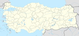
Arap Islet (Turkish: Arap Adası) is an uninhabited island of Turkey. According to Turkish Atlas it is situated on the borderline of Aegean Sea and the Mediterranean Sea.[1] Administratively it is a part of Marmaris ilçe (district) of Muğla Province at 36°39′5″N 28°8′48″E / 36.65139°N 28.14667°E.[2] It is very close to the mainland (Anatolia). The channel between the mainland and the island is quite shallow; no more than 6 metres (20 ft).[3] Its surface area is about 0.025 square kilometres (0.0097 sq mi).
References
[edit]- ^ Sabri Duran:Büyük Atlas ISBN 975-7537-04-7, p. 27
- ^ Map page
- ^ Coastquide (in Turkish)

