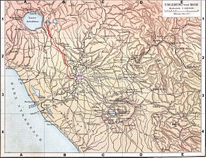
Aqua Augusta (Rome)
Appearance

The Aqua Augusta, which was also called the Aqua Alsietina,[1] was an aqueduct supplying ancient Rome.The Emperor Augustus built the Aqua Augusta in order to supplement the Aqua Marcia, and then later the Aqua Claudia when required.
The aqueduct, perhaps via a branch, also fed the town of Feronia as mentioned in inscriptions found there.[2]
References
[edit]- ^ Frontinus, De aquaeductu 11
- ^ A. M. Sgubini Moretti - Enciclopedia dell' Arte Antica (1995), LUCUS FERONIAE Vol. IV, p. 725 and 1970, p. 442
External links
[edit]- University of Utrecht Archived 2007-03-11 at the Wayback Machine
- University of Chicago
41°53′12″N 12°28′10″E / 41.88667°N 12.46944°E

