Aponte Indigenous Reserve
This article has multiple issues. Please help improve it or discuss these issues on the talk page. (Learn how and when to remove these messages)
|
Aponte Indigenous Reserve | |
|---|---|
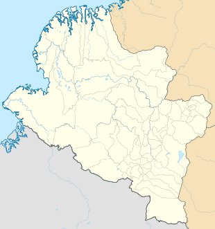
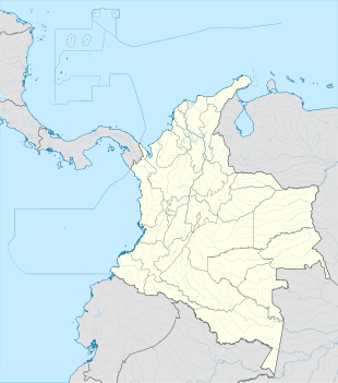
Location in Nariño Department and Indonesia | |
| Coordinates: 1°23′14.6904″N 76°58′35.4288″W / 1.387414000°N 76.976508000°W | |
| Country | |
| Department | Nariño Department |
| Municipality | El Tablon de Gomez Municipality |
| Elevation | 10,715 ft (3,266 m) |
| Population | |
| • Total | ~10,000 |
| Time zone | UTC-5 (Colombia Standard Time) |
Aponte is an indigenous reserve in El Tablon de Gómez municipality. It is located in the northern part of the department of Nariño, in southern Colombia, with approximately 5000 inhabitants, and is a native of the Inga ethnic group from the Quechua people. Its community has its own language and being an indigenous reserve, it has special rules imposed by its community, under the command of the indigenous governor and the indigenous guard.[1]
History
[edit]According to historians, it is said that the first inhabitants came to this land at the beginning of the 16th century, from the department of Putumayo, exactly Valley Sibundoy valley, ruled by the Cacique Carlos Tamabioy, a native of Santiago Putumayo. They began the journey by a bridle path through the thick jungle that separates these two towns. To this day this path is still preserved, used by ancestors to communicate between the two sister communities.
Climate
[edit]The climate of Aponte Indigenous Reserve ranges from subtropical highland climate (Cfb) in the lower parts to subpolar oceanic climate (Cfc) and Tundra climate (ET) in the higher parts. The following climate data is for the central part of the reserve which has a borderline Tundra climate and subpolar oceanic climate.
| Climate data for Aponte Indigenous Reserve | |||||||||||||
|---|---|---|---|---|---|---|---|---|---|---|---|---|---|
| Month | Jan | Feb | Mar | Apr | May | Jun | Jul | Aug | Sep | Oct | Nov | Dec | Year |
| Mean daily maximum °C (°F) | 14.0 (57.2) |
13.7 (56.7) |
14.0 (57.2) |
14.2 (57.6) |
14.0 (57.2) |
13.1 (55.6) |
12.1 (53.8) |
12.5 (54.5) |
13.3 (55.9) |
14.2 (57.6) |
14.2 (57.6) |
13.8 (56.8) |
13.6 (56.5) |
| Daily mean °C (°F) | 9.4 (48.9) |
9.4 (48.9) |
9.6 (49.3) |
9.9 (49.8) |
9.9 (49.8) |
9.2 (48.6) |
8.5 (47.3) |
8.7 (47.7) |
9.0 (48.2) |
9.6 (49.3) |
9.7 (49.5) |
9.3 (48.7) |
9.4 (48.8) |
| Mean daily minimum °C (°F) | 4.9 (40.8) |
5.2 (41.4) |
5.2 (41.4) |
5.6 (42.1) |
5.8 (42.4) |
5.4 (41.7) |
5.0 (41.0) |
4.9 (40.8) |
4.8 (40.6) |
5.1 (41.2) |
5.2 (41.4) |
4.9 (40.8) |
5.2 (41.3) |
| Average precipitation mm (inches) | 142 (5.6) |
147 (5.8) |
193 (7.6) |
255 (10.0) |
272 (10.7) |
277 (10.9) |
316 (12.4) |
225 (8.9) |
173 (6.8) |
206 (8.1) |
185 (7.3) |
167 (6.6) |
2,558 (100.7) |
| Source: Climate-Data.org[2] | |||||||||||||
References
[edit]- ^ "Donde se encuentra el resguardo indígena de aponte" [Where is the Aponte indigenous reservation located?]. Cocupo (in Spanish). 22 March 2015. Archived from the original on 29 November 2016. Retrieved 25 August 2024.
- ^ "Climate: Resguardo Indigena Aponte". Climate-Data.org. Retrieved July 28, 2020.


