Alenquer, Pará
Appearance
Alenquer | |
|---|---|
Municipality | |
 | |
| Coordinates: 1°56′41″S 54°43′55″W / 1.944818°S 54.732019°W | |
| Country | |
| Region | Northern |
| State | Pará |
| Mesoregion | Baixo Amazonas |
| Population (2020 [1]) | |
• Total | 57,092 |
| Time zone | UTC−3 (BRT) |
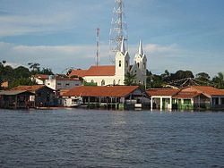
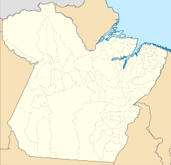
Alenquer is a municipality in the state of Pará in the Northern region of Brazil.[2][3][4][5] The town is located on the northern bank of the Amazon River, roughly across from the city of Santarém.
The city is served by Alenquer Airport.[6]
Conservation
[edit]The municipality contains roughly half of the 216,601 hectares (535,230 acres) Mulata National Forest, a sustainable use conservation unit created in 2001.[7] The north of the municipality contains part (13.31%) of the 4,245,819 hectares (10,491,650 acres) Grão-Pará Ecological Station, the largest fully protected tropical forest conservation unit on the planet.[8] It contains 2% of the 3,172,978 hectares (7,840,600 acres) Trombetas State Forest, created in 2006.[9]
Notable people
[edit]- Delival Nobre (b. 1948), sports shooter[10]
See also
[edit]References
[edit]- ^ IBGE 2020
- ^ "Divisão Territorial do Brasil" (in Portuguese). Divisão Territorial do Brasil e Limites Territoriais, Instituto Brasileiro de Geografia e Estatística (IBGE). July 1, 2008. Retrieved December 17, 2009.
- ^ "Estimativas da população para 1º de julho de 2009" (PDF) (in Portuguese). Estimativas de População, Instituto Brasileiro de Geografia e Estatística (IBGE). August 14, 2009. Retrieved December 17, 2009.
- ^ "Ranking decrescente do IDH-M dos municípios do Brasil" (in Portuguese). Atlas do Desenvolvimento Humano, Programa das Nações Unidas para o Desenvolvimento (PNUD). 2000. Archived from the original on October 3, 2009. Retrieved December 17, 2009.
- ^ "Produto Interno Bruto dos Municípios 2002-2005" (PDF) (in Portuguese). Instituto Brasileiro de Geografia e Estatística (IBGE). December 19, 2007. Archived from the original (PDF) on October 2, 2008. Retrieved December 17, 2009.
- ^ "Aeródromos". ANAC (in Portuguese). 29 June 2020. Retrieved 8 April 2021.
- ^ FLONA de Mulata (in Portuguese), ISA: Instituto Socioambiental, retrieved 2016-06-01
- ^ Estação Ecológica Grão-Pará (in Portuguese), Ideflor-bio (Government of Pará), archived from the original on 2020-09-26, retrieved 2016-05-12
- ^ FES do Trombetas (in Portuguese), ISA: Instituto Socioambiental, retrieved 2016-09-07
- ^ "Delival da Fonseca". Olympedia.org. Retrieved 8 April 2021.
Wikimedia Commons has media related to Alenquer (Pará).


