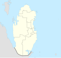
Al Samriya
Appearance
Al Samriya
السمرية | |
|---|---|
Village | |
 View of the village in 2012 | |
| Coordinates: 25°21′53″N 51°16′51″E / 25.36472°N 51.28083°E | |
| Country | |
| Municipality | Al-Shahaniya |
| Zone | Zone 80 |
| District no. | 215 |
| Area | |
• Total | 19.3 sq mi (50.1 km2) |
Al Samriya (Arabic: السمرية, romanized: As Samrīyah) is a village in Qatar located in the municipality of Al-Shahaniya. It is considered to be a locality of the nearby city of Al-Shahaniya, which is the municipal seat. The Sheikh Faisal Bin Qassim Al Thani Museum is a notable attraction in the village.[2] West of the village is the Al-Shahaniya Camel Racetrack.[3]
Etymology
[edit]Al Samriya derives its name from the Samr tree (Latin name Acacia tortilis), which commonly grows in rawdas (depressions) throughout central Qatar.[4][5]
Al Samriya Farm
[edit]A commercial 85-hectare farm is found here. In 1998, 20 hectares were used to grow crops such as cucumber, green beans and sweet peppers in eight greenhouses.[6]
References
[edit]- ^ "District Area Map". Ministry of Development Planning and Statistics. Retrieved 20 May 2019.
- ^ "تركيا تستضيف متحف الشيخ فيصل بن قاسم آل ثاني" (in Arabic). Al Raya. 28 May 2016. Retrieved 15 July 2018.
- ^ "الريضان حمت شيبانا وآباءنا في سنوات القحط" (in Arabic). Al Raya. 12 March 2018. Retrieved 15 July 2018.
- ^ "Samr". Qatar e-Nature. Retrieved 10 August 2019.
- ^ "GIS Portal". Ministry of Municipality and Environment. Archived from the original on 18 November 2018. Retrieved 15 July 2018.
- ^ Protected Agriculture in the Arabian Peninsula: Summary Proceedings of an International Workshop: Protected Agriculture in the Arabian Peninsula Doha (Qatar) 15-18 Feb 1998. ICARDA. 1998. p. 92.

