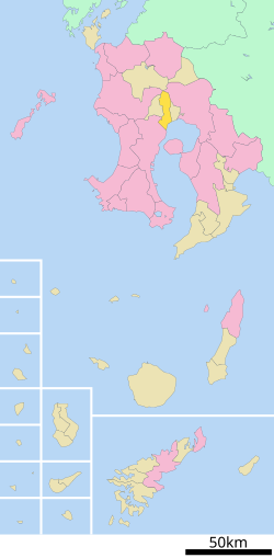
Aira, Kagoshima (Aira District)
Appearance

Aira (姶良町, Aira-cho) was a town located in Aira District, Kagoshima Prefecture, Japan. It was located west of Kajiki and north of Kagoshima.
On March 23, 2010, Aira absorbed the towns of Kajiki and Kamō (all from Aira District) to create the city of Aira. Aira District will be left with one municipality.[1]
As of 2003, the town had an estimated population of 44,029 and the density of 429.47 persons per km2. The total area was 102.52 km2.
References
[edit]- ^ "市町村合併情報 鹿児島県 <国土地理協会>". Archived from the original on 2008-04-18. Retrieved 2008-09-13.
External links
[edit]- Aira City official website (in Japanese)
