Agger (river)
Appearance
| Agger | |
|---|---|
 | |
 | |
| Location | |
| Country | Germany |
| State | North Rhine-Westphalia |
| Physical characteristics | |
| Source | |
| • location | Sauerland |
| Mouth | |
• location | Sieg |
• coordinates | 50°48′2″N 7°10′27″E / 50.80056°N 7.17417°E |
| Length | 69.5 km (43.2 mi)[1] |
| Basin size | 816 km2 (315 sq mi)[1] |
| Basin features | |
| Progression | Sieg→ Rhine→ North Sea |
| Tributaries | |
| • left | Wiehl, Naafbach |
| • right | Leppe, Sülz |
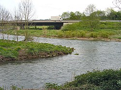
The Agger is a river in Germany, a right tributary of the Sieg in North Rhine-Westphalia. It is 69.5 kilometres (43.2 mi) long. Its source is in the Sauerland hills, near Meinerzhagen. It winds through the towns Engelskirchen, Overath and Lohmar. Near Siegburg the Agger flows into the Sieg.
Tributaries
[edit]The following rivers are tributaries to the river Agger (from source to mouth):
- Left: Rengse, Dörspe, Steinagger, Halstenbach, Wiehl, Kaltenbach, Loopebach, Schlingenbach, Lombach, Hohner Bach, Naafbach, Jabach, Auelsbach, Rothenbach
- Right: Genkel, Seßmarbach, Rospebach, Strombach, Loper Bach, Walbach, Leppe, Oberscheider Bach, Sülz
See also
[edit]References
[edit]
