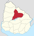
Achar, Uruguay
Appearance
Achar | |
|---|---|
Village | |
| Coordinates: 32°24′0″S 56°11′0″W / 32.40000°S 56.18333°W | |
| Country | |
| Department | Tacuarembó Department |
| Population (2011) | |
• Total | 687 |
| Time zone | UTC -3 |
| Dial plan | +598 46 (+6 digits) |
Achar is a village in the Tacuarembó Department of northern-central Uruguay.
Geography
[edit]The village is located on Route 43, 10 kilometres (6.2 mi) east of Route 5, on the intersection with the railroad track.
History
[edit]On 21 August 1936, the status of the populated centre here was elevated to "Pueblo" (village) by the Act of Ley Nº 9.587.[1]
Population
[edit]In 2011 Achar had a population of 687.[2]
| Year | Population |
|---|---|
| 1908 | 2,708 |
| 1963 | 770 |
| 1975 | 608 |
| 1985 | 561 |
| 1996 | 637 |
| 2004 | 780 |
| 2011 | 687 |
Source: Instituto Nacional de Estadística de Uruguay[3]
Places of worship
[edit]Mars
[edit]The name Achar has been used for a crater on the planet Mars by the International Astronomical Union, although not specifically commemorating the village.[4]
References
[edit]- ^ "Ley Nº 9.587". República Oriental del Uruguay, Poder Legislativo. 1936. Archived from the original on 4 March 2016. Retrieved 6 September 2012.
- ^ "Censos 2011 Tacuarembó (needs flash plugin)". INE. 2012. Archived from the original on 7 January 2013. Retrieved 25 August 2012.
- ^ "Statistics of urban localities (1963–2004)". INE. 2012. Archived from the original (PDF) on 23 March 2015. Retrieved 6 September 2012.
- ^ Categories for Naming Features on Planets and Satellites, Gazetteer of Planetary Nomenclature, USGS Astrogeology Science Center, NASA
External links
[edit]


