A5038 road
Appearance
| A5038 | ||||
|---|---|---|---|---|
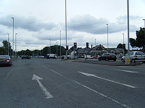
 A5036/A5038 junction | ||||
| Location | ||||
| Country | United Kingdom | |||
| Constituent country | England | |||
| Road network | ||||
| ||||
The A5038 is a road in Liverpool, England. It runs between the A562 Parliament Street and the A5036 Church Road/Dunnings Bridge Road.
Route
[edit]It starts on the A562 Parliament Street, and passes Liverpool Lime Street railway station as Lime Street and the carries on to end as Netherton Way in Netherton with a junction with the A5036 road.
References
[edit]53°26′22″N 2°58′53″W / 53.43948°N 2.98133°W

