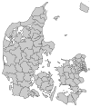
Odsherred Municipality
Appearance
(Redirected from 2025 Odsherred municipal election)
Odsherred Municipality
Odsherred Kommune (Danish) | |
|---|---|
 | |
 | |
| Coordinates: 55°55′53″N 11°39′43″E / 55.9314°N 11.6619°E | |
| Country | Denmark |
| Region | Zealand |
| Established | 1 January 2007 |
| Seat | Nykøbing Sjælland |
| Government | |
| • Mayor | Thomas Adelskov (S) |
| Area | |
• Total | 355.3 km2 (137.2 sq mi) |
| Population (1. January 2024)[1] | |
• Total | 32,605 |
| • Density | 92/km2 (240/sq mi) |
| Time zone | UTC+1 (CET) |
| • Summer (DST) | UTC+2 (CEST) |
| Municipal code | 306 |
| Website | www |
Odsherred Municipality (Danish: Odsherred Kommune) is a kommune in Odsherred, Region Sjælland in Denmark. It covers an area of 355 km² with a total population of 32,605 (2024). Its seat is the town of Højby.
History
[edit]On 1 January 2007 Odsherred municipality was created as the result of Kommunalreformen ("The Municipal Reform" of 2007), consisting of the former municipalities of Dragsholm, Nykøbing-Rørvig, and Trundholm
Urban areas
[edit]The ten largest urban areas in the municipality are:
| # | Locality | Population |
|---|---|---|
| 1 | Nykøbing Sjælland | 5,212 |
| 2 | Asnæs | 2,914 |
| 3 | Hørve | 2,394 |
| 4 | Fårevejle Stationsby | 1,794 |
| 5 | Vig | 1,514 |
| 6 | Højby | 1,462 |
| 7 | Rørvig | 1.056 |
| 8 | Fårevejle Kirkeby | 717 |
| 9 | Havnebyen | 648 |
| 10 | Grevinge | 640 |
Politics
[edit]Municipal council
[edit]Odsherred's municipal council consists of 25 members, elected every four years.
Below are the municipal councils elected since the Municipal Reform of 2007.
| Election | Party | Total seats |
Turnout | Elected mayor | |||||||||
|---|---|---|---|---|---|---|---|---|---|---|---|---|---|
| A | B | C | F | L | O | V | Ø | ||||||
| 2005 | 10 | 2 | 1 | 1 | 2 | 9 | 25 | 70.2% | Finn Madsen (A) | ||||
| 2009 | 9 | 1 | 3 | 1 | 3 | 8 | 68.6% | Thomas Adelskov (A) | |||||
| 2013 | 11 | 1 | 2 | 2 | 8 | 1 | 73.8% | ||||||
| 2017 | 12 | 1 | 1 | 1 | 2 | 7 | 1 | 72.9% | |||||
| Data from Kmdvalg.dk 2005, 2009, 2013 and 2017 | |||||||||||||
See also
[edit]References
[edit]- ^ BY2: Population 1. January by municipalities The Mobile Statbank from Statistics Denmark
- Municipal statistics: NetBorger Kommunefakta, delivered from KMD a.k.a. Kommunedata (Municipal Data)
- Municipal mergers and neighbors: Eniro new municipalities map
External links
[edit]Wikimedia Commons has media related to Odsherred Kommune.


