1984 Llŷn Peninsula earthquake
| UTC time | 1984-07-19 06:56:10 |
|---|---|
| ISC event | 549253 |
| USGS-ANSS | ComCat |
| Local date | 19 July 1984 |
| Local time | 07:56 (UTC +1) |
| Magnitude | 5.4 ML |
| Depth | 20.7 kilometres (13 mi) |
| Epicentre | 52°58′N 4°23′W / 52.96°N 4.38°W |
| Areas affected | United Kingdom Ireland |
| Max. intensity | MMI VI (Strong) EMS-98 VI (Slightly damaging) |
| Casualties | Several injured |
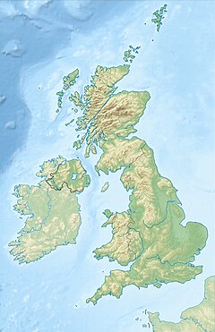
The 1984 Llŷn Peninsula earthquake struck the Llŷn Peninsula in Gwynedd, northwest Wales on Thursday 19 July 1984 at 06:56 UTC (07:56 BST). Measuring 5.4 on the Richter scale, it is the largest onshore earthquake to occur in the UK since instrumental measurements began.[1][2]
The effects were felt throughout Wales, most of England, and parts of Ireland and Scotland. There were many reports of minor damage to chimneys and masonry throughout Wales and England, the biggest concentration of damage being in Liverpool, which is located around 65 miles northeast of the epicentre.[2] Minor injuries were also reported in the areas surrounding the epicentral area, and rockslides occurred at Tremadog in Gwynedd.[3]
The 19 July earthquake was followed by many aftershocks in the following months, the largest measuring 4.3 on the Richter scale, which itself was felt as far away as Dublin, in Ireland.[4]
See also
[edit]References
[edit]- ^ "BGS FAQ What are the largest two instrumental, onshore earthquakes?". British Geological Survey. Archived from the original on 9 October 2007. Retrieved 10 October 2007.
- ^ a b "19 July 1984 Lleyn Peninsula". BGS. Archived from the original on 9 June 2007. Retrieved 10 October 2007.
- ^ "USGS Significant earthquakes of the world 1984". United States Geological Survey. Archived from the original on 12 October 2007. Retrieved 10 October 2007.
- ^ "Manchester Earthquake Sequence report (Mentions this event)". BGS. Archived from the original on 6 August 2007. Retrieved 10 October 2007.


