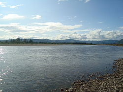
Üür River
Appearance
| Üür River | |
|---|---|
 | |
 | |
| Native name | Үүрийн гол (Mongolian) |
| Location | |
| Country | Mongolia |
| Aimags | Khövsgöl |
| Physical characteristics | |
| Source | |
| • location | Tsagaan-Üür sum |
| • coordinates | 51°9′5″N 101°35′35″E / 51.15139°N 101.59306°E |
| Mouth | Egiin Gol |
• location | Erdenebulgan sum |
• coordinates | 50°18′0″N 101°56′0″E / 50.30000°N 101.93333°E |
| Basin features | |
| Progression | Egiin Gol→ Selenga→ Lake Baikal→ Angara→ Yenisey→ Kara Sea |
| Tributaries | |
| • left | Uilgan River |
| • right | Arigiin River |
The Üür River (Mongolian: Үүрийн гол) is a river in the Khövsgöl aimag of northern Mongolia. It starts in about 30 km from the Russian border in Tsagaan-Üür sum, from the confluence of the Old Üür (Хөгшин Үүр) and the Young Üür (Залуу Үүр).[1] The river is a tributary of the Egiin Gol, which it meets in the Erdenebulgan sum.[2]
See also
[edit]References
[edit]- ^ "Russian army map "100k--m47-036"". Maps for the world. Retrieved 2015-01-05.
- ^ "Russian army map "100k--m47-072"". Maps for the world. Retrieved 2015-01-05.
www.medeelel.mn (in Mongolian)
