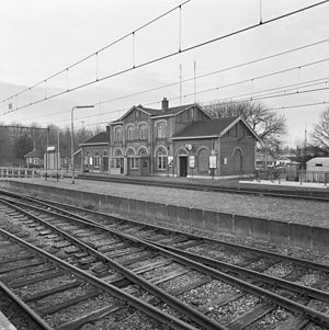
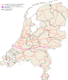
't Harde railway station
Appearance
't Harde | |||||||||||
|---|---|---|---|---|---|---|---|---|---|---|---|
 Railway station in 1973 | |||||||||||
| General information | |||||||||||
| Location | Netherlands | ||||||||||
| Coordinates | 52°24′32″N 5°53′35″E / 52.40889°N 5.89306°E | ||||||||||
| Line(s) | Utrecht–Kampen railway | ||||||||||
| History | |||||||||||
| Opened | 1863 | ||||||||||
| Services | |||||||||||
| |||||||||||
| |||||||||||
't Harde railway station is located in 't Harde, Netherlands. The station was opened on 20 August 1863 and is located on the Amersfoort–Zwolle section of the Utrecht–Kampen railway (Centraalspoorweg).[1] The services are operated by Nederlandse Spoorwegen. Previously, the station was called Elburg-Epe (1863-1888), Elburg-Oldebroek(1888-1914) and Legerplaats Oldebroek (1914-1963).
Train services
[edit]| Route | Service type | Notes |
|---|---|---|
| Utrecht – Amersfoort – Harderwijk – Zwolle | Local ("Sprinter") | 2x per hour |
Bus services
[edit]| Line | Route | Operator | Notes |
|---|---|---|---|
| 514 | Wezep - 't Loo - Oldebroek - Oosterwolde - Elburg - Hoge Enk - 't Harde | Syntus Gelderland | Mon-Fri during daytime hours only. |
References
[edit]- ^ Station 't Harde on Stationsweb.nl (in Dutch)
External links
[edit]- NS website (in Dutch)
- Dutch Public Transport journey planner (in Dutch)

