Yalkharoy
Yalkharoy
Ялхорой | |
|---|---|
| Other transcription(s) | |
| • Chechen | Яхлара |
| • Ingush | Ялхаре |
| Coordinates: 42°55′13″N 45°16′28″E / 42.92028°N 45.27444°E | |
| Country | Russia |
| Federal subject | Chechnya |
| Population | |
• Total | 0 |
• Estimate (2021)[2] | 0 |
| • Subordinated to | Urus-Martanovsky District |
Yalkharoy[a] is a rural locality (a selo) in Urus-Martanovsky District of the Republic of Chechnya, Russia.
Location
[edit]
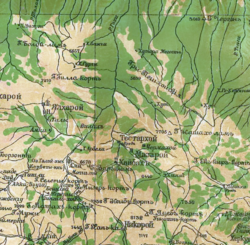
Yalkhara is located in the center of Galanchozhsky District. It is located 4 kilometres (2.5 mi) north-west of Aka-Bass and 56 kilometres (35 mi) south-west of Grozny.
The closest settlements to Yalkhara are Tsecha-Äkhk in the west, Aka-Bass in the south, and Khaybakha in the south-east.[5]
History
[edit]
Yalkharoy is the ancestral home of the Yalkharoy teip.
In the second half of the 18th century (1770s), the German researcher J. A. Güldenstädt mentioned the village of Yalkharoy as part of the district of "Sholkha" which according to him was called "Little Angusht" by the Russians due to its proximity to Angusht proper.[6] Yalkharoy among the villages of the Ingush in 1823 was also mentioned by S. M. Bronevskiy.[7]


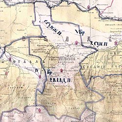
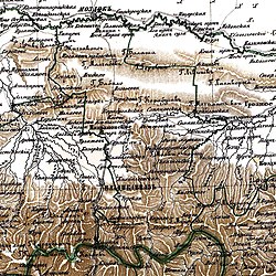
According to the Regulations on the management of the Terek Oblast in 1862, the Ingushskiy Okrug was established as part of the Western Department. It included societies of Nazranians, Karabulaks, Galgai, Kistins, Akkins and Tsorins[8] (also Meredzhin society and some Galanchozh and Yalkharoy auls).[9] The village of Yalkharoy was part of the Gorsky section of the Ingush district.[9] In 1866 the village of Yalkharoy (Meredzhi society, some Galanchozh, Yalkharoy auls and Akkin society) was ceded to the Argunskiy Okrug due to them belonging to the same nation as the locals (Chechen) and geographically closer to the central governance of the Okrug.[10]
From 1940 to 1944, Yalkhara was the administrative center of Galanchozhsky District. On 27 February 1944, after the genocide and deportation of the Chechen and Ingush people and the Chechen-Ingush ASSR was abolished, the village of Yalkhara was abandoned and destroyed.
In 1957, after the Vaynakh people returned and the Chechen-Ingush ASSR was restored, the former residents of Galanchozhsky District were forbidden to resettle there. As a result, most former residents of Yalkhara resettled in the flat lands of the republic, mostly in the Achkhoy-Martanovsky, Groznensky and Sernovodsky districts.
In 2019, Yalkhara was named as one of the first 7 settlements in Galanchozhsky District to be rebuilt in order to resettle the area.[11][12]
Demographics
[edit]National censuses done by the Russian empire and the Soviet Union in 1874,1883,1891, 1914 and 1926 showed that all of the inhabitants of Yalkharoy and its surrounding villages were ethnic Chechens in all 5 censuses. [13][14][15][16][17]
Notable people
[edit]- Dzhokhar Dudayev, major general of Soviet Air Force and the first president of Chechen Republic of Ichkeria.[18]
Notes
[edit]References
[edit]- ^ Russian Federal State Statistics Service (2011). Всероссийская перепись населения 2010 года. Том 1 [2010 All-Russian Population Census, vol. 1]. Всероссийская перепись населения 2010 года [2010 All-Russia Population Census] (in Russian). Federal State Statistics Service.
- ^ "Таблица 5. Численность населения России, федеральных округов, субъектов Российской Федерации, городских округов, муниципальных районов, муниципальных округов, городских и сельских поселений, городских населенных пунктов, сельских населенных пунктов с населением 3000 человек и более". Всероссийской переписи населения 2020 года
- ^ a b "Ярташ". "Даймохк" газет (in Russian).
- ^ ГӀалгӀай фольклор 1991, p. 28.
- ^ "Карта Чеченской республики подробная с районами, селами и городами. Схема и спутник онлайн". 1maps.ru.
- ^ Гюльденштедт 2002, p. 241.
- ^ Броневский 1823, p. 166.
- ^ Сборник документов и материалов 2020, pp. 255–257.
- ^ a b Сборник статистических сведений о Кавказе 1869, p. 45.
- ^ https://viewer.rusneb.ru/ru/000200_000018_RU_NLR_BIBL_A_012304072?page=3&rotate=0&theme=white
- ^ Узел, Кавказский. "Власти Чечни отрапортовали о более чем 6500 желающих переехать в Галанчожский район". Кавказский Узел.
- ^ Kosumov, Lom-Ali. "В Галанчожском районе Чечни продолжается строительство дорожных коммуникаций". ЧГТРК "Грозный".
- ^ https://viewer.rusneb.ru/ru/000200_000018_v19_rc_1224684?page=32&rotate=0&theme=white
- ^ "Statistical tables of populated areas of the Terek region / ed. Tersk. stat. com. ed. Evg. Maksimov. — Vladikavkaz, 1890—1891. — 7 t. p. 60". Archived from the original on 2019-05-22. Retrieved 2023-02-01.
- ^ "Settled results of the 1926 census in the North Caucasus region — Don State Public". Archived from the original on 2021-10-20. Retrieved 2023-02-01.
- ^ https://viewer.rusneb.ru/ru/000200_000018_v19_rc_1519880?page=64&rotate=0&theme=white
- ^ http://elib.shpl.ru/ru/nodes/46057-spisok-naselennyh-mest-terskoy-oblasti-po-dannym-k-1-mu-iyulya-1914-goda-vladikavkaz-1915#mode/inspect/page/175/zoom/9
- ^ "Джохар Мусаевич Дудаев - Биографии, мемуары, истории".
Bibliography
[edit]- Гюльденштедт, Иоганн Антон (2002). VI. Провинция Кистия, или Кистетия // Путешествие по Кавказу в 1770-1773 гг [Province of Kistia, or Kistetia // Journey through the Caucasus in 1770-1773] (in Russian). Санкт-Петербург: Петербургское Востоковедение. pp. 238–243.
- Дахкильгов, И. А. (1977). Вайнаьха багахбувцам [Folklore of Vainakhs] (in Ingush). Грозный: Нохч-ГӀалгӀай Паччахьалкхен Университет. pp. 1–218.
- Броневский, С. М. (1823). Кисты (глава третья) // Новейшие географические и исторические известия о Кавказе (часть вторая) [Kists (chapter three) // The latest geographical and historical news about the Caucasus (part two)] (PDF) (in Russian). Москва: Типография С. Селивановского. pp. 151–186.
- Ингушетия в политике Российской империи на Кавказе. XIX век. Сборник документов и материалов (in Russian). Ростов-на-Дону: Южный издательский дом. 2020. pp. 1–760. ISBN 978-5-98864-060-8.
- Воронов, Н. И.; Кавказский отдел Императорского русского географического общества (1869). "Список горских аулов Кубанской и Терской областей" [List of mountain villages of the Kuban and Terek Oblasts]. Сборник статистических сведений о Кавказе [Collection of statistical information about the Caucasus] (in Russian). Тифлис: Типографія Главнаго управленіи намѣстника Кавказскаго; типогрфія Меликова и К. pp. 41–52 (418–429 as PDF).
- Танкиев, А. Х. (1991). Дахкильгов, И. А. (ed.). ГӀалгӀай фольклор [Ingush folklore] (in Ingush). Грозный: Книга. pp. 1–448. ISBN 5-7666-0186-7.


