Wellsville, Colorado
Appearance
(Redirected from Wellsville Warm Spring)
Wellsville, Colorado[1] | |
|---|---|
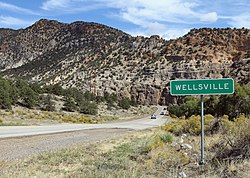
 Wellsville and U.S. Highway 50 | |
| Coordinates: 38°29′12″N 105°54′36″W / 38.48667°N 105.91000°W | |
| Country | United States |
| State | Colorado |
| County | Fremont County |
| Elevation | 6,893 ft (2,101 m) |
Wellsville, Colorado is a small unincorporated community in western Fremont County, Colorado, United States. The town straddles the banks of the Arkansas River and follows the U.S. Route 50 before the road starts winding through tight curves into Chaffee County. Wellsville is the site of US Soil's processing facility, where it mines a natural fertilizer from an ancient lake bed.[2]
See also
[edit]References
[edit]- ^ a b "Wellsville". Geographic Names Information System. United States Geological Survey, United States Department of the Interior.
- ^ Sering, Ron (June 1, 2010). "US Soil: Family finds Fertile Ground for Mining in Wellsville". Colorado Central Magazine. Retrieved August 18, 2018.
External links
[edit]Wikimedia Commons has media related to Wellsville, Colorado.


