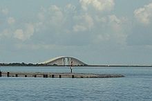
List of waterways forming and crossings of the Gulf Intracoastal Waterway
Appearance
(Redirected from Waterways forming and crossings of the Gulf Intracoastal Waterway)
This is a list of waterways that form the Gulf Intracoastal Waterway and crossings (bridges, tunnels and ferries) across it. The list runs from west to east (Brownsville, Texas to Carrabelle, Florida), in order of decreasing mile markers to Harvey, Louisiana and increasing after Harvey.
Texas
[edit]
- Brownsville Ship Channel
- Port Isabel Ship Channel
- South Garcia Street Drawbridge
- Laguna Madre
- Manmade canal
- Laguna Madre
- Manmade canal
- Baffin Bay
- Manmade canal
- Corpus Christi Bay
- Manmade canal
- Redfish Bay
- Redfish Bay Causeway (SH 361)
- Manmade canal
- Aransas Bay
- Manmade canal
- San Antonio Bay
- Manmade canal
- Matagorda Bay
- Manmade canal
- Oyster Lake
- Manmade canal
- Colorado River Locks (West side)
- Colorado River
- Manmade canal
- Colorado River Locks (East side)
- FM 2031 Bridge (FM 2031)
- Manmade canal
- East Matagorda Bay
- Manmade canal
- Sergeant Joe Parks, Jr. Memorial Bridge (FM 457)
- Manmade canal
- San Bernard River
- Manmade canal
- Brazos River
- West Gate of the Brazos River
- East Gate of the Brazos River
- Manmade canal
- Manmade canal
- Galveston Bay
- West Bay
- Galveston Bay
- Manmade canal
- Sievers Cove
- Manmade canal
- East Bay
- Manmade canal
- Trinity River
- Manmade canal
- Texas 124 Bridge (SH 124)
- Sabine–Neches Waterway
- South Gulfway Drive Bridge (SH 87)
- Taylor Bayou
- Manmade canal
- Neches River
- Sabine Lake
- Sabine River
Louisiana
[edit]
- Sabine River
- Manmade canal
- Calcasieu River
- Manmade canal
- Black Bayou Pontoon Bridge (LA 384)
- Grand Lake Pontoon Bridge (LA 384)
- Gibbstown Bridge (LA 27)
- Forked Island Bridge (LA 82)
- Louisa Bridge (LA 319)
- Ferry to Cote Blanche Island
- LA 317 bridge at North Bend
- Atchafalaya River
- Bayou Boeuf
- Bayou Chene
- Bayou Black
- Bayou Cocodrie
- Lake Cocodrie
- Manmade canal
- Bayou Dularge
- Houma Navigational Canal
- Houma Tunnel (LA 3040)
- East Main Street Bridge (LA 24 eastbound)
- East Park Avenue Bridge (LA 24 westbound)
- LA 3087 bridge
- LA 316 bridge
- Larose-Bourg Cutoff (manmade)
- Manmade canal
- LA 308 bridge
- Bayou Barataria
- LA 3134 bridge
- Harvey Canal (manmade)
- Mississippi River
- Industrial Canal (manmade)
- St. Claude Avenue Bridge (LA 46)
- Claiborne Avenue Bridge (LA 39)
- Florida Avenue Bridge (road and railroad)
- Mississippi River-Gulf Outlet Canal (manmade)[3]
- Manmade canal
- Lake Borgne
Mississippi
[edit]Alabama
[edit]
- Mississippi Sound
- Mobile Bay
- Bon Secour Bay
- Manmade canal
- Perdido Bay
Florida
[edit]
- Big Lagoon
- Pensacola Bay
- Pensacola Pass
- Pensacola Beach Bridge
- SR 399
- Brooks Bridge (US 98)
- Santa Rosa Sound
- Choctawhatchee Bay
- West Bay
- St. Andrews Bay
- East Bay
- Apalachicola Bay
- St. George Sound
See also
[edit]References
[edit]- ^ "Port Isabel (GIWW) Channel Improvements at the Queen Isabella Causeway. Laguna Madre, Texas, Navigation Improvement Project".
{{cite journal}}: Cite journal requires|journal=(help) - ^ 2007 Mississippi River Cairo to the Gulf Navigation Charts. USACE, Vicksburg District PAO. p. 27. Retrieved 2018-03-23.
- ^ "Goodbye MRGO: Work begins to close shortcut to Gulf of Mexico". NOLA.com. 2009-01-31. Retrieved 2009-01-31.
