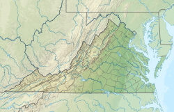
Urbanna Creek
Appearance
(Redirected from Urbanna Creek (Rappahannock River tributary))
| Urbanna Creek Tributary to Rappahannock River | |
|---|---|
 Urbanna Creek in Urbanna, Virginia | |
| Location | |
| Country | United States |
| State | Virginia |
| County | Middlesex |
| City | Urbanna |
| Physical characteristics | |
| Source | Dam at Town Bridge Pond |
| • location | about 0.5 miles southwest of Urbanna, Virginia |
| • coordinates | 37°38′06″N 076°35′57″W / 37.63500°N 76.59917°W[1] |
| • elevation | 0 ft (0 m)[2] |
| Mouth | Rappahannock River |
• location | Urbanna, Virginia |
• coordinates | 37°38′30″N 076°34′04″W / 37.64167°N 76.56778°W[1] |
• elevation | 0 ft (0 m)[2] |
| Length | 3.52 mi (5.66 km)[3] |
| Basin size | 9.69 square miles (25.1 km2)[4] |
| Discharge | |
| • location | Rappahannock River |
| • average | 10.94 cu ft/s (0.310 m3/s) at mouth with Rappahannock River[4] |
| Basin features | |
| Progression | Rappahannock River → Chesapeake Bay → Atlantic Ocean |
| River system | Rappahannock River |
| Tributaries | |
| • left | Town Bridge Swamp |
| • right | Glebe Swamp |
| Waterbodies | Town Bridge Pond |
| Bridges | Town Bridge Road, Urbanna Road |
Urbanna Creek is a 3.52 mi (5.66 km) long 3rd order tributary to the Rappahannock River in Middlesex County, Virginia. The stream is tidal is for its entire distance.
Variant names
[edit]According to the Geographic Names Information System, it has also been known historically as:[1]
- Nimcock Creek
- Urbana Creek
Course
[edit]Urbanna Creek begins at the Town Bridge Pond dam about 0.5 miles southwest of Urbanna, Virginia. Urbanna Creek then flows southeast then northeast to meet the Rappahannock River at Urbanna, Virginia.[2]
Watershed
[edit]Urbanna Creek drains 9.69 square miles (25.1 km2) of area, receives about 45.8 in/year of precipitation, has a topographic wetness index of 432.65 and is about 54.8% forested.[4]
Maps
[edit]

See also
[edit]References
[edit]- ^ a b c "GNIS Detail - Urbanna Creek". geonames.usgs.gov. US Geological Survey. Retrieved 12 March 2020.
- ^ a b c "Urbanna Creek Topo Map, Middlesex County VA (Urbanna Area)". TopoZone. Locality, LLC. Retrieved 12 March 2020.
- ^ "ArcGIS Web Application". epa.maps.arcgis.com. US EPA. Retrieved 12 March 2020.
- ^ a b c "Urbanna Creek Watershed Report". Waters Geoviewer. US EPA. Retrieved 12 March 2020.


