Tư Nghĩa district
Appearance
(Redirected from Tư Nghĩa)
You can help expand this article with text translated from the corresponding article in Vietnamese. (March 2009) Click [show] for important translation instructions.
|
Tư Nghĩa district
Huyện Tư Nghĩa | |
|---|---|
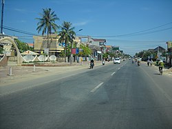
 Street view along La Hà road | |
 | |
| Country | |
| Region | South Central Coast |
| Province | Quảng Ngãi province |
| Capital | La Hà |
| Area | |
• Total | 88 sq mi (227 km2) |
| Population (2003) | |
• Total | 178,132 |
| Time zone | UTC+7 (UTC + 7) |
Tư Nghĩa () is a rural district (huyện) of Quảng Ngãi province in the South Central Coast region of Vietnam. As of 2003 the district had a population of 178,132.[1] The district covers an area of 227 km2. The district capital lies at La Hà.[1]
References
[edit]- ^ a b "Districts of Vietnam". Statoids. Retrieved March 20, 2009.

