Sutter Basin
| Sutter Basin | |
|---|---|
| Geography | |
| Country | United States |
| State | California |
| Region | Lower Feather Watershed |
| Coordinates | 38°53′07″N 121°36′54″W / 38.8854°N 121.615°W |
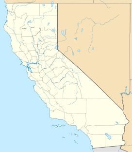
The Sutter Basin is a 264 sq mi (680 km2)[1] area of the Sacramento Valley in the U.S. state of California, and is part of the Feather River drainage basin. The basin includes the Sutter Basin Fire Protection District of ~127 sq mi (330 km2)[2] and uses irrigation from the Thermalito Afterbay's Sutter-Butte Canal.[3] The Feather River and the Sutter By-Pass are the basin's east and southwest borders.
Sutter Bypass
[edit]
The Sutter Bypass is a leveed channel of the Lower Sacramento Valley Flood-Control System along the southwest portion of the Sutter Basin.[4] The bypass allows channeling of escapement flow from the Tisdale Weir near the Sutter Buttes to the Feather River at 38°53′08″N 121°36′52″W / 38.885421°N 121.614532°W. During Sacramento River flows of >23,000 cu ft/s (650 m3/s), Sacramento overflow tops the 53 ft (16 m) Tisdale Weir[5] and flows via the Sutter Bypass[6][7] to Feather River mile 7[8]: 3–55 (the west levee of the bypass continues along the Feather River to the Sacramento River).[9]
The bypass also receives similar Sacramento escapement flow from the Colusa Weir,[9] and the Snake River, Gilsizer Slough, Wadsworth Canal, and other west side watercourses of the Lower Feather Watershed also drain to the Feather River via the Sutter Bypass,[10] The bypass includes 3.24 sq mi (8.4 km2) of the Sutter National Wildlife Refuge,[11] which is part of California's ~5.00 sq mi (12.9 km2) Sutter Bypass Wildlife Area.[12]
See also
[edit]References
[edit]- ^ Engineering and Contracting. Vol. 39. Gillette Publishing Company. 1913. p. 404. Retrieved 2015-08-25.
- ^ "Services1". Archived from the original on 1999-10-11. Retrieved 2015-08-25.
- ^ "Exhibit A: Project Description" (PDF). CA Department of Water Resources. Retrieved 2010-10-17.
- ^ "Sutter By-Pass (GNIS code 233372)". Geographic Names Information System. United States Geological Survey, United States Department of the Interior. Retrieved 2010-10-06.
- ^ "National Weather Service Advanced Hydrologic Prediction Service". water.weather.gov. Retrieved 2015-08-25.
- ^ "USGS Gage #11425000 on the Feather River near Nicolaus". National Water Information System. United States Geological Survey. 1944–1983. Retrieved 2010-09-08.[outdated source]
- ^ "USGS Gage #11390500 on the Sacramento River below Wilkins Slough, near Grimes, California: Water-Data Report 2009" (PDF). National Water Information System. United States Geological Survey. 2009. Retrieved 2010-08-25.
- ^ "Section 2: Proposed Action and Alternatives". Final Environmental Impact Statement for the Oroville Facilities Project. Federal Energy Regulatory Commission. p. 17. Retrieved 2010-09-15. NOTE: Pumpback returns Feather River water back to Lake Oroville during off-peak periods when external California Edison Company (SCE) power is inexpensive, allowing subsequent hydroelectric generation (6-7% of Hyatt total) during peak (higher price) periods.
- ^ a b Singer, Michael Bliss; et al. "Status of the Lower Sacramento Valley Flood-Control System within the Context of Its Natural Geomorphic Setting" (PDF). UCSB.edu. Retrieved 2010-10-12.
A large volume of the sediments from the Feather River have been permanently deposited in the lower 13 km of Sutter Bypass with which that river is coincident and a large secondary delta has been built up at the northerly end
- ^ "9.6 Water Resources". TBD. CERES.CA.gov. Retrieved 2010-10-13.
The Bypass starts north of Pass Road, westerly of the Sutter Buttes and generally goes in a south-southeast direction for about 27 miles
- ^ "Welcome to the National Wildlife Refuge System". FWS.gov. Retrieved 2010-10-07.
- "Sutter National Wildlife Refuge". Areas of Interest. Retrieved 2010-10-07.
Habitat: 2,591 acres comprised of seasonal marsh, permanent ponds, and uplands.
- "Sutter National Wildlife Refuge". Profiles. Retrieved 2010-10-07.
About 80 percent of the refuge is located in the Sutter Bypass
- "Sutter National Wildlife Refuge". Areas of Interest. Retrieved 2010-10-07.
- ^ "Sutter Bypass Wildlife Area – Sutter County". California Department of Fish and Game. Retrieved 2010-10-07. (map of area)

