Stanton, Texas
Stanton, Texas | |
|---|---|
 Welcome to Stanton sign on I-20 | |
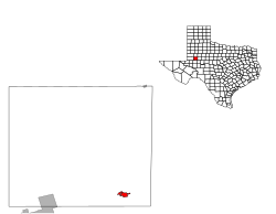
 Location of Stanton, Texas | |
| Coordinates: 32°7′51″N 101°47′31″W / 32.13083°N 101.79194°W | |
| Country | United States |
| State | Texas |
| County | Martin |
| Area | |
• Total | 1.99 sq mi (5.16 km2) |
| • Land | 1.99 sq mi (5.14 km2) |
| • Water | 0.01 sq mi (0.02 km2) |
| Elevation | 2,664 ft (812 m) |
| Population | |
• Total | 2,657 |
| • Density | 1,338.54/sq mi (516.81/km2) |
| Time zone | UTC-6 (Central (CST)) |
| • Summer (DST) | UTC-5 (CDT) |
| ZIP code | 79782 |
| Area code | 432 |
| FIPS code | 48-70040[3] |
| GNIS feature ID | 1347803[4] |
| Website | www |

Stanton is a city in and the county seat of Martin County, Texas, United States.[5] Stanton was founded as Marienfeld by German immigrants that were some of the first settlers in this region of Texas.[6] The population was 2,657 at the 2020 census.[2]
History
[edit]In 1887, New York native John Scharbauer established a cattle ranch in what later became known as Stanton.[7]
Geography
[edit]Stanton is located at 32°7′51″N 101°47′31″W / 32.13083°N 101.79194°W (32.130740, –101.792072).[8]
According to the United States Census Bureau, the city has a total area of 1.8 square miles (4.7 km2), of which 1.8 square miles (4.7 km2) is land and 0.56% is water.
Demographics
[edit]| Census | Pop. | Note | %± |
|---|---|---|---|
| 1930 | 1,384 | — | |
| 1940 | 1,245 | −10.0% | |
| 1950 | 1,603 | 28.8% | |
| 1960 | 2,228 | 39.0% | |
| 1970 | 2,117 | −5.0% | |
| 1980 | 2,314 | 9.3% | |
| 1990 | 2,576 | 11.3% | |
| 2000 | 2,556 | −0.8% | |
| 2010 | 2,492 | −2.5% | |
| 2020 | 2,657 | 6.6% | |
| U.S. Decennial Census[9] | |||
2020 census
[edit]| Race | Number | Percentage |
|---|---|---|
| White (NH) | 1,100 | 41.4% |
| Black or African American (NH) | 67 | 2.52% |
| Native American or Alaska Native (NH) | 13 | 0.49% |
| Asian (NH) | 6 | 0.23% |
| Pacific Islander (NH) | 1 | 0.04% |
| Some Other Race (NH) | 10 | 0.38% |
| Mixed/Multi-Racial (NH) | 25 | 0.94% |
| Hispanic or Latino | 1,435 | 54.01% |
| Total | 2,657 |
As of the 2020 United States census, there were 2,657 people, 889 households, and 711 families residing in the city.
2000 census
[edit]As of the census[3] of 2000, there were 2,556 people, 854 households, and 651 families living in the city. The population density was 1,458.1 inhabitants per square mile (563.0/km2). There were 1,002 housing units at an average density of 571.6 per square mile (220.7/km2). The racial makeup of the city was 73.98% White, 2.86% African American, 0.74% Native American, 0.31% Asian, 19.56% from other races, and 2.54% from two or more races. Hispanic or Latino of any race were 52.90% of the population.
There were 854 households, out of which 44.8% had children under the age of 18 living with them, 59.0% were married couples living together, 13.7% had a female householder with no husband present, and 23.7% were non-families. 22.7% of all households were made up of individuals, and 13.0% had someone living alone who was 65 years of age or older. The average household size was 2.92 and the average family size was 3.44.
In the city, the population was spread out, with 35.0% under the age of 18, 7.9% from 18 to 24, 26.0% from 25 to 44, 16.7% from 45 to 64, and 14.4% who were 65 years of age or older. The median age was 30 years. For every 100 females, there were 87.4 males. For every 100 females age 18 and over, there were 84.9 males.
The median income for a household in the city was $27,961, and the median income for a family was $32,768. Males had a median income of $27,647 versus $18,333 for females. The per capita income for the city was $13,634. About 19.7% of families and 22.0% of the population were below the poverty line, including 26.0% of those under age 18 and 22.0% of those age 65 or over.
Education
[edit]Residents are in the Stanton Independent School District.[12]
Notable people
[edit]- Craig Eiland, Texas state representative from Galveston; born in Stanton in 1962
- Michael Salgado, Tejano singer; born in Stanton in 1971
References
[edit]- ^ "2020 U.S. Gazetteer Files". United States Census Bureau. Retrieved February 9, 2024.
- ^ a b "Profile of General Population and Housing Characteristics: 2020 Demographic Profile Data (DP-1): Stanton city, Texas". United States Census Bureau. Retrieved February 9, 2024.
- ^ a b "U.S. Census website". United States Census Bureau. Retrieved January 31, 2008.
- ^ "US Board on Geographic Names". United States Geological Survey. October 25, 2007. Retrieved January 31, 2008.
- ^ National Association of Counties. "NACo County Explorer". Retrieved February 9, 2024.
- ^ "TSHA | Germans".
- ^ Collett, James (2010). Midland. Mount Pleasant, South Carolina: Arcadia Publishing. p. 28. ISBN 9780738578965. Retrieved January 4, 2016.
- ^ "US Gazetteer files: 2010, 2000, and 1990". United States Census Bureau. February 12, 2011. Retrieved April 23, 2011.
- ^ "Census of Population and Housing". Census.gov. Retrieved June 4, 2015.
- ^ "Explore Census Data". data.census.gov. Retrieved May 20, 2022.
- ^ "About the Hispanic Population and its Origin". www.census.gov. Retrieved May 18, 2022.
- ^ "2020 CENSUS - SCHOOL DISTRICT REFERENCE MAP: Martin County, TX" (PDF). U.S. Census Bureau. Retrieved April 25, 2022.

