Snee Oosh, Washington
Snee Oosh, Washington
sdiʔus | |
|---|---|
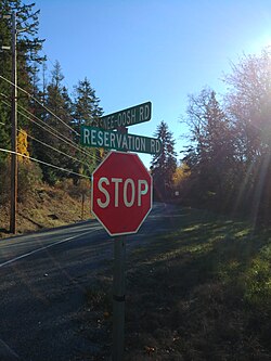
 Stop sign at the intersection of Snee-Oosh Road and Reservation Road | |
 | |
| Named for | "look the other way" |
| Population (1999) | |
• Total | 302 |
Snee Oosh (also spelled Snee-Oosh or Snee-oosh; Lushootseed: sdiʔus) is a populated place on Fidalgo Island in the U.S. state of Washington, on the Swinomish Indian Reservation.[1][2] The population was reported as 302 in 1999.[3]
There is also a Snee Oosh Point at 48°24′01″N 122°32′51″W / 48.40028°N 122.54750°W,[4][5] and Snee Oosh Beach at 48°24′07″N 122°32′38″W / 48.40194°N 122.54389°W.[6]
History
[edit]Snee Oosh is the site of one of the main Swinomish villages occupied in historic times.[7] The name "Snee Oosh" is derived from the Lushootseed name, sdiʔus, which means "look the other way."[8]
Kukutali Preserve
[edit]The Kukutali Preserve, an extension of Deception Pass State Park jointly administered by the Swinomish and Washington State Parks in a unique arrangement, is adjacent to Snee Oosh, and occupies the entirety of Flagstaff Island and Kiket Island.[9][10] It is the first state–tribal co-managed park in the United States.[11] Kiket Island was once the planned site of a nuclear power plant.[12]

References
[edit]- ^ U.S. Geological Survey Geographic Names Information System: Snee Oosh, Washington
- ^ "BOUNDARY MAP DETAIL", official website, Swinomish Tribe, 2017, retrieved 2018-11-16
- ^ Washington State Yearbook 1999.
- ^ Washington Administrative Code title 237 GEOGRAPHIC NAMES, BOARD ON (appendix) (PDF) (2005 ed.), Washington State Legislature, p. 4
- ^ U.S. Geological Survey Geographic Names Information System: Snee-oosh Point
- ^ U.S. Geological Survey Geographic Names Information System: Snee-oosh Beach
- ^ Dailey, Tom. "Village Descriptions--Lummi-Bellingham". Coast Salish Map. Archived from the original on 2003-02-13. Retrieved 2024-01-02.
- ^ Hilbert, Vi; Miller, Jay; Zahir, Zalmai (2001). sdaʔdaʔ gʷəɬ dibəɬ ləšucid ʔacaciɬtalbixʷ - Puget Sound Geography. Original Manuscript from T.T. Waterman. Lushootseed Press. pp. 348, 351. ISBN 979-8750945764.
- ^ VISITING KUKUTALI PRESERVE, Swinomish Tribe, retrieved 2018-11-16
- ^ Kimberly Cauvel (June 18, 2014), "Kukutali Preserve opens to the public – Swinomish, state Parks partnership the first of its kind", goskagit.com, Skagit Valley Herald
- ^ Romano 2017.
- ^ Wilma, David "Kiket Island" HistoryLink.org (October 24, 2001).
Bibliography
[edit]- Washington State Yearbook, Information Press, 1999
- Romano, Craig (2017), Urban Trails Bellingham: Chuckanut Mountains // Western Whatcom // Skagit Valley, The Mountaineers Books, p. 158, ISBN 978-1-68051-025-6
48°25′20″N 122°33′16″W / 48.42222°N 122.55444°W

