Coomsaharn char
| Coomsaharn char | |
|---|---|
| Scientific classification | |
| Domain: | Eukaryota |
| Kingdom: | Animalia |
| Phylum: | Chordata |
| Class: | Actinopterygii |
| Order: | Salmoniformes |
| Family: | Salmonidae |
| Genus: | Salvelinus |
| Species: | S. fimbriatus
|
| Binomial name | |
| Salvelinus fimbriatus | |
The Coomsaharn char (Salvelinus fimbriatus; the spellings Coomasaharn and charr are also used; Irish: ruabhreac Chom Sathairn) is a species of lacustrine char fish in the family Salmonidae.[3]
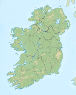
It is only located in Lough Coomsaharn, County Kerry, Ireland.[4][5]
Taxonomy
[edit]Name
[edit]The English word "char[r]" is thought to derive from Old Irish ceara/cera meaning "[blood] red,"[6] referring to its pink-red underside.[7][8] This would also connect with its Welsh name torgoch, "red belly."[9]
Lough Coomsaharn (/ˌkuːməˈsæhərən/) derives its name from the Irish Com Sathairn, "hollow of Saturday(?)".[10]
Biology
[edit]Salvelinus fimbriatus spawns in November/December and feeds on zooplankton. It is distinguished from other Salvelinus in Ireland by large eyes,[11] having 27–30 gill rakers, with 16–20 on the lower part (hence the species name fimbriatus, "fringed").[12] Also, its body depth is 20–25% of snout length, the snout is conical, and the lower jaw is not included in the upper one; an adaptation that helps it to feed on plankton.[13]
History
[edit]The Coomsaharn char are a remnant fish of the Last Ice Age.[14]
References
[edit]- ^ Freyhof, J.; Kottelat, M. (2008). "Salvelinus fimbriatus". IUCN Red List of Threatened Species. 2008: e.T135411A4125761. doi:10.2305/IUCN.UK.2008.RLTS.T135411A4125761.en. Retrieved 12 November 2021.
- ^ "WoRMS - World Register of Marine Species - Salvelinus fimbriatus Regan, 1908". www.marinespecies.org.
- ^ Stendall, J. A. Sidney; Kertland, Mary P. H. (27 February 1961). "The Irish Naturalists' Journal". I.N.J. Committee. – via Google Books.
- ^ Academy, Royal Irish (27 February 2018). "Proceedings of the Royal Irish Academy: Mathematical and physical sciences" – via Google Books.
- ^ Hendroff, Adrian (30 March 2015). Killarney to Valentia Island – The Iveragh Peninsula: A Walking Guide. The Collins Press. ISBN 9781848895522 – via Google Books.
- ^ "eDIL - Irish Language Dictionary". edil.qub.ac.uk.
- ^ Skeat, Walter W. (15 February 2013). An Etymological Dictionary of the English Language. Courier Corporation. ISBN 9780486317656 – via Google Books.
- ^ Various. Chambers's Twentieth Century Dictionary (part 1 of 4: A-D). Library of Alexandria. ISBN 9781465562883 – via Google Books.
- ^ Weekley, Ernest (5 March 2013). An Etymological Dictionary of Modern English. Courier Corporation. ISBN 9780486122878 – via Google Books.
- ^ "Com Sathairn/Coomasaharn". Logainm.ie.
- ^ MacMahon, Alexander Francis Magri (27 February 2018). "Fishlore: British Freshwater Fishes". Penguin Books – via Google Books.
- ^ Cullen, P.; McCarthy, T. K.; Doherty, D. (2007). "The Coomasaharn char, a morphometrically highly specialised form of Salvelinus alpinus in Ireland". Ecology of Freshwater Fish. 16: 41–46. doi:10.1111/j.1600-0633.2006.00163.x.
- ^ Cullen, P; Mccarthy, T; Doherty, D (1 March 2007). "The Coomasaharn char, a morphometrically highly specialised form of Salvelinus alpinus in Ireland". Ecology of Freshwater Fish. 16: 41–46. doi:10.1111/j.1600-0633.2006.00163.x – via ResearchGate.
- ^ "Ireland - Lake Coomasaharn".


