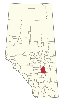
County of Stettler No. 6
County of Stettler No. 6 | |
|---|---|
 Engine 41 of the Alberta Prairie Railway | |
Major communities | |
 Location within Alberta | |
| Country | Canada |
| Province | Alberta |
| Region | Central Alberta |
| Planning region | Red Deer |
| Established | 1943 |
| Incorporated | 1955 (County) |
| Government | |
| • Reeve | Larry Clarke |
| • Governing body | County of Stettler Council |
| • Administrative office | Stettler |
| Area (2021)[2] | |
| • Land | 3,969.65 km2 (1,532.69 sq mi) |
| Population (2021)[2] | |
• Total | 5,666 |
| • Density | 1.4/km2 (4/sq mi) |
| Time zone | UTC−7 (MST) |
| • Summer (DST) | UTC−6 (MDT) |
| Website | stettlercounty.ca |
The County of Stettler No. 6 is a municipal district in central Alberta, Canada.
Geography
[edit]Communities and localities
[edit]|
The following urban municipalities are surrounded by the Stettler County No. 6.[3]
The following hamlets are located within the County of Stettler No. 6.[3] |
The following localities are located within the County of Stettler No. 6.[5]
|
Demographics
[edit]In the 2021 Census of Population conducted by Statistics Canada, the County of Stettler No. 6 had a population of 5,666 living in 1,945 of its 2,310 total private dwellings, a change of 1.8% from its 2016 population of 5,566. With a land area of 3,969.65 km2 (1,532.69 sq mi), it had a population density of 1.4/km2 (3.7/sq mi) in 2021.[2]
In the 2016 Census of Population conducted by Statistics Canada, the County of Stettler No. 6 had a population of 5,322 living in 1,850 of its 2,137 total private dwellings, a 4.3% change from its 2011 population of 5,103. With a land area of 4,018.84 km2 (1,551.68 sq mi), it had a population density of 1.3/km2 (3.4/sq mi) in 2016.[6]
See also
[edit]References
[edit]- ^ Alberta Municipal Affairs: Municipal Officials Search
- ^ a b c "Population and dwelling counts: Canada, provinces and territories, and census subdivisions (municipalities)". Statistics Canada. February 9, 2022. Retrieved February 9, 2022.
- ^ a b "Specialized and Rural Municipalities and Their Communities" (PDF). Alberta Municipal Affairs. June 3, 2024. Retrieved June 14, 2024.
- ^ "O.C. 239/2017". Government of Alberta. June 12, 2017. Retrieved September 30, 2017.
- ^ "Standard Geographical Classification (SGC) 2006, Economic Regions: 4807019 - Stettler County No. 6, geographical codes and localities, 2006". Statistics Canada. March 5, 2010. Archived from the original on April 24, 2012. Retrieved August 12, 2012.
- ^ "Population and dwelling counts, for Canada, provinces and territories, and census subdivisions (municipalities), 2016 and 2011 censuses – 100% data (Alberta)". Statistics Canada. February 8, 2017. Retrieved February 8, 2017.

