Quebec Route 237
Appearance
(Redirected from Quebec Route 108 (pre-1970s))
 | ||||
| Route information | ||||
| Maintained by Transports Québec | ||||
| Length | 14.8 km[1] (9.2 mi) | |||
| Major junctions | ||||
| South end | ||||
| North end | ||||
| Location | ||||
| Country | Canada | |||
| Province | Quebec | |||
| Highway system | ||||
| ||||
Route 237 is a short 15 km north/south provincial highway on the south shore of the Saint Lawrence River in Quebec. Its northern terminus is in Stanbridge East at the junction of Route 202 and its southern terminus is in Frelighsburg, where it crosses the US border and continues past the West Berkshire–Frelighsburg Border Crossing into Vermont as Route 108.
Municipalities along Route 237
[edit]-
Route 237 connects with Vermont Route 108 at the Canada–US border
-
Route 237 crosses Frelighsburg village in a southeast-northwest fashion.
-
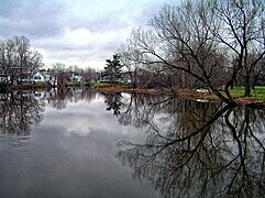
Route 237 follows the course of Pike River between the border and Stanbridge East.
Major intersections
[edit]The entire route is in Brome-Missisquoi RCM.
| Location | km | mi | Destinations | Notes | |
|---|---|---|---|---|---|
| Frelighsburg | 0 | 0.0 | West Berkshire–Frelighsburg Border Crossing; southern terminus | ||
| Southern terminus of Route 213 | |||||
| Stanbridge East | 14.8 | 9.2 | Northern terminus | ||
| 1.000 mi = 1.609 km; 1.000 km = 0.621 mi | |||||
See also
[edit]References
[edit]- ^ Ministère des transports, "Distances routières", page 87, Les Publications du Québec, 2005
External links
[edit]- Route 237 on Google Maps
- Provincial Route Map (Courtesy of the Quebec Ministry of Transportation) (in French)


