Pulham Market
| Pulham Market | |
|---|---|
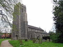
 St Mary Magdalene Church, Pulham Market | |
Location within Norfolk | |
| Area | 12.08 km2 (4.66 sq mi) |
| Population | 977 (2011) |
| • Density | 81/km2 (210/sq mi) |
| OS grid reference | TM196862 |
| Civil parish |
|
| District | |
| Shire county | |
| Region | |
| Country | England |
| Sovereign state | United Kingdom |
| Post town | DISS |
| Postcode district | IP21 |
| Dialling code | 01379 |
| Police | Norfolk |
| Fire | Norfolk |
| Ambulance | East of England |
Pulham Market is a village and civil parish in Norfolk, England, about 8 miles (13 km) northeast of Diss and 14 miles (23 km) south of Norwich. The parish covers an area of 12.08 km2 (4.66 sq mi) and had a population of 977, at the 2011 census,[1] almost unchanged from 999 in 443 households at the 2001 census.[2]
History
[edit]
The earliest recorded spelling is Polleham. Pulham is referenced in the Domesday Book of 1086 as a single manor (including both Pulham Market and Pulham St Mary as we know them today) and being part of the Earsham hundred. The name Pulham is thought to mean the farmhouse, homestead or enclosure by the pool, water meadow or stream.[3] There is a 'beck' (Norfolk dialect for a small watercourse) that flows by both villages.

Older maps and documents name the parish or village "Pulham Saint Mary Magdalene" after the dedication of its parish church. The neighbouring parish and village was historically known as "Pulham Saint Mary the Virgin" after the dedication of its own parish church, though it is these days typically abbreviated to Pulham St Mary. In modern times the two villages of Pulham St Mary and Pulham Market are often together described as The Pulhams, including on road signs in the surrounding areas.
The village was struck by an F0/T1 tornado on 23 November 1981, part of the record-breaking nationwide tornado outbreak on that day.[4] Another tornado later struck nearby Pulham St Mary.
As of 2019, the village has a primary school, a doctors' surgery, two pubs (The Crown and The Falcon), a shop/post office, and several other community facilities.[5]
Transport
[edit]As of May 2024, the 36A/B bus service run by FirstGroup links the town of Harleston and Norwich City Centre, passing through the village;[6] on weekdays there is a limited 584 service to Diss, run by Simonds CountryLink.[7]
The nearest railway station is Diss. Pulham Market once had its own station on the Waveney Valley Line which is now closed. The long-distance footpath Boudica's Way runs through the village.
See also
[edit]Notes
[edit]- ^ "Parish population 2011". Retrieved 4 September 2015.
- ^ "Pulham Market parish information". South Norfolk Council. 20 March 2008. Archived from the original on 7 November 2007. Retrieved 20 June 2009.
- ^ "Pulham St. Mary Magdalen". Key to English Place-Names. University of Nottingham. Retrieved 8 May 2024.
- ^ "European Severe Weather Database".
- ^ "Welcome to Pulham Market". Pulham Market Parish Council. Retrieved 8 May 2024.
- ^ "36, 37, 38, 39 Purple Line" (PDF). First Bus Norfolk & Suffolk. Retrieved 8 May 2024.
- ^ "Local Bus Services". Simonds. Retrieved 8 May 2024.
External links
[edit]![]() Media related to Pulham Market at Wikimedia Commons
Media related to Pulham Market at Wikimedia Commons

