Zaplava
Zaplava
Заплава | |
|---|---|
| Coordinates: 46°37′48″N 32°50′01″E / 46.63°N 32.833611°E | |
| Country | Ukraine |
| Oblast | Kherson Oblast |
| Raion | Kherson Raion |
| Hromada | Oleshky urban hromada |
| Area | |
| • Total | 0.05 km2 (0.02 sq mi) |
| Elevation | 11 m (36 ft) |
| Population | |
| • Total | 117 |
| • Density | 2,300/km2 (6,100/sq mi) |
| Time zone | UTC+2 (EET) |
| • Summer (DST) | UTC+3 (EEST) |
| Postal code | 75100 |
| Area code | +380 5542 |
 | |
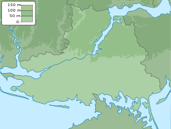
Zaplava (Ukrainian: Заплава), known in 2016–2024 as Poima (Ukrainian: Пойма) and before 2016 as Tsiurupynsk (Ukrainian: Цюрупинськ), is a rural-type settlement in Ukraine, located in Oleshky urban hromada, Kherson Raion, Kherson Oblast.[2]
History
[edit]In accordance with decommunization laws in Ukraine, Tsiurupynsk was renamed to Poima by the Ukrainian parliament in 2016.[3] The previous name, Tsiurupynsk, was given in honour of former CPSU Central Committee member and Gosplan chairman Alexander Tsiurupa, born in nearby Oleshky.
During the Russian invasion of Ukraine in 2022, it was occupied by Russia.[4]
On 23 September 2023, the administration of Oleshky urban hromada began discussions on renaming Poima to Zaplava. This was as a result of a decision by the National Commission for State Language Standards on 22 June, determining that the name of the settlement was not in line with state language standards, as it was a transliteration from Russian. Zaplava is the native Ukrainian equivalent of Poima. Poima was one of 43 settlements in Kherson Oblast recommended to be renamed in the decision.[5]
Poima was reportedly recaptured by Ukraine on October 18, 2023 during an incursion across the Dnieper river.[4][6]
In September 2024, Poima was renamed to Zaplava.[7]
Demographics
[edit]In 2001 the settlement had 117 inhabitants, native language as of the 2001 Ukrainian census:[1]
References
[edit]- ^ a b "All-Ukrainian population census". db.ukrcensus.gov.ua. State Statistics Service of Ukraine. Retrieved 19 October 2023.
- ^ "Пойма - Херсонська область". decentralization.gov.ua. Retrieved 18 October 2023.
- ^ "Про перейменування окремих населених пунктів та районів". Офіційний вебпортал парламенту України (in Ukrainian). Retrieved 18 October 2023.
- ^ a b "Ukrainian forces cross Dnipro river in major tactical advance". Retrieved 19 October 2023.
- ^ Василевська, Єва (23 September 2023). "На Херсонщині селище Пойма пропонують перейменувати у Заплаву" (in Ukrainian). Retrieved 16 November 2023.
- ^ Jaroslav Lukiv (19 October 2023). "Ukraine war: Kyiv troop build-up reported across Dnipro river". bbc.com. BBC News. Retrieved 20 October 2023.
"Geolocated footage published on 18 October indicates that Ukrainian forces advanced north of Pishchanivka (14km east of Kherson City and 3km from the Dnipro River) and into [the village of] Poyma (11km east of Kherson City and 4km from the Dnipro River)," the US-based think tank added.
- ^ Про перейменування окремих населених пунктів та районів [On renaming individual populated places and raions]. Verkhovna Rada of Ukraine. Retrieved 26 September 2024.


