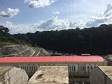
Campo River
Appearance
(Redirected from Ntem River)
2°21′0″N 9°49′0″E / 2.35000°N 9.81667°E
| Designations | |
|---|---|
| Official name | Río Ntem o Campo |
| Designated | 2 June 2003 |
| Reference no. | 1310[1] |
| Official name | Partie Camerounaise du Fleuve Ntem |
| Designated | 5 June 2012 |
| Reference no. | 2067[2] |

The Campo (Spanish: Río Campo, French: Rivière Ntem) or Ntem River is a border river in Cameroon, mainland Equatorial Guinea and Gabon. It rises in Gabon, and flows into the Atlantic Ocean in Cameroon in the Bight of Biafra.
Towns
[edit]
See also
[edit]References
[edit]- ^ "Río Ntem o Campo". Ramsar Sites Information Service. Retrieved 25 April 2018.
- ^ "Partie Camerounaise du Fleuve Ntem". Ramsar Sites Information Service. Retrieved 25 April 2018.
