[ 3] Name on the Register[ 4]
Image
Date listed[ 5]
Location
City or town
Description
1
Anderson-Clark Farmstead Anderson-Clark Farmstead February 3, 2006 (#05001627 ) 378 W. Clark St. 40°36′10″N 112°28′37″W / 40.6028°N 112.4769°W / 40.6028; -112.4769 (Anderson-Clark Farmstead ) Grantsville
2
Benson Mill Benson Mill April 14, 1972 (#72001260 ) 325 S. State Route 138 40°39′03″N 112°17′47″W / 40.6508°N 112.2964°W / 40.6508; -112.2964 (Benson Mill ) Stansbury Park
3
Black Rock Site Black Rock Site March 24, 2021 (#100006332 ) 2.5 miles (4.0 km) west of jct. UT 202 and I 80 40°43′30″N 112°13′40″W / 40.72503°N 112.22774°W / 40.72503; -112.22774 (Black Rock Site ) Lake Point vicinityBlack Rock and the foundation ruins of Black Rock Resort. Listed area extends into Salt Lake County .
4
Bonneville Salt Flats Race Track Bonneville Salt Flats Race Track December 18, 1975 (#75001826 ) 3 miles (4.8 km) east of Wendover off Interstate 80 40°47′41″N 113°47′37″W / 40.7947°N 113.7936°W / 40.7947; -113.7936 (Bonneville Salt Flats Race Track ) Wendover
5
Peter Clegg House Peter Clegg House September 30, 2019 (#100004483 ) 8 South 100 East 40°31′49″N 112°17′45″W / 40.5303°N 112.2957°W / 40.5303; -112.2957 (Peter Clegg House ) Tooele
6
Danger Cave Danger Cave October 15, 1966 (#66000741 ) Northeast of Wendover off Interstate 80 40°44′58″N 114°00′51″W / 40.7494°N 114.0142°W / 40.7494; -114.0142 (Danger Cave ) Wendover
7
David E. Davis House David E. Davis House November 8, 2007 (#07001172 ) 400 E. State Route 199 40°20′14″N 112°26′10″W / 40.3372°N 112.4361°W / 40.3372; -112.4361 (David E. Davis House ) Rush Valley
8
Hilda Erickson House Hilda Erickson House July 11, 2006 (#05001626 ) 247 W. Main St. 40°35′59″N 112°28′15″W / 40.5997°N 112.4708°W / 40.5997; -112.4708 (Hilda Erickson House ) Grantsville
9
GAPA Launch Site and Blockhouse Upload image August 26, 1980 (#80003972 ) Northeast of Knolls 40°49′41″N 113°12′07″W / 40.8281°N 113.2019°W / 40.8281; -113.2019 (GAPA Launch Site and Blockhouse ) Knolls
10
Grantsville First Ward Meetinghouse Grantsville First Ward Meetinghouse February 11, 1982 (#82004165 ) 297 W. Clark St. 40°36′07″N 112°28′21″W / 40.6019°N 112.4725°W / 40.6019; -112.4725 (Grantsville First Ward Meetinghouse ) Grantsville
11
Grantsville School and Meetinghouse Grantsville School and Meetinghouse December 13, 1995 (#95001432 ) 90 N. Cooley St. 40°36′08″N 112°28′22″W / 40.6022°N 112.4728°W / 40.6022; -112.4728 (Grantsville School and Meetinghouse ) Grantsville
12
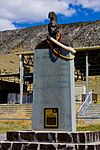
Iosepa Settlement Cemetery Iosepa Settlement Cemetery August 12, 1971 (#71000856 ) Skull Valley 40°32′25″N 112°43′57″W / 40.5403°N 112.7325°W / 40.5403; -112.7325 (Iosepa Settlement Cemetery ) Iosepa
13
Johnson Hall-Deseret Mercantile Building Johnson Hall-Deseret Mercantile Building February 3, 2006 (#05001628 ) 4 W. Main St. 40°36′00″N 112°27′49″W / 40.6°N 112.4636°W / 40.6; -112.4636 (Johnson Hall-Deseret Mercantile Building ) Grantsville
14
Alex and Mary Alice Johnson House Alex and Mary Alice Johnson House December 13, 1995 (#95001433 ) 5 W. Main St. 40°35′59″N 112°27′47″W / 40.5997°N 112.4631°W / 40.5997; -112.4631 (Alex and Mary Alice Johnson House ) Grantsville
15
The Kirk Hotel The Kirk Hotel January 21, 2020 (#100004880 ) 57 West Vine St. 40°31′49″N 112°18′01″W / 40.5304°N 112.3003°W / 40.5304; -112.3003 (The Kirk Hotel ) Tooele Hotel built in 1927-28.
16
Lawrence Brothers and Company Store Lawrence Brothers and Company Store October 16, 2013 (#13000842 ) 31 E. Main St. 40°22′09″N 112°15′23″W / 40.3692°N 112.2564°W / 40.3692; -112.2564 (Lawrence Brothers and Company Store ) Ophir
17
Lincoln Highway Bridge Lincoln Highway Bridge May 21, 1975 (#75001825 ) In Ditto Area on 2nd St. over Government Creek, just south of Tucker St. 40°10′58″N 112°55′23″W / 40.1828°N 112.9231°W / 40.1828; -112.9231 (Lincoln Highway Bridge ) Dugway Proving Ground
18
Ophir Town Hall Ophir Town Hall June 9, 1983 (#83003193 ) 57 E. Main St. 40°22′12″N 112°15′15″W / 40.3699°N 112.2543°W / 40.3699; -112.2543 (Ophir Town Hall ) Ophir
19
Reddick Hotel-Ophir LDS Meetinghouse Reddick Hotel-Ophir LDS Meetinghouse September 27, 2016 (#16000680 ) 2nd bldg. W. of Moore St., S. Side of Main St. 40°22′11″N 112°15′19″W / 40.3696°N 112.2553°W / 40.3696; -112.2553 (Reddick Hotel-Ophir LDS Meetinghouse ) Ophir
20
John T. Rich House John T. Rich House May 2, 1984 (#84002423 ) 275 W. Clark St. 40°36′07″N 112°28′18″W / 40.6019°N 112.4717°W / 40.6019; -112.4717 (John T. Rich House ) Grantsville
21
John C. Sharp House John C. Sharp House July 13, 1984 (#84002424 ) Off State Route 36 40°05′16″N 112°26′03″W / 40.0878°N 112.4342°W / 40.0878; -112.4342 (John C. Sharp House ) Vernon
22
Soldier Creek Kilns Soldier Creek Kilns August 19, 1980 (#80003973 ) Address Restricted[ 6] Stockton
23
Stockton Jail Stockton Jail May 9, 1985 (#85000965 ) 38 W. Clark St. 40°27′14″N 112°21′47″W / 40.4539°N 112.3631°W / 40.4539; -112.3631 (Stockton Jail ) Stockton
24
Stockton School Stockton School December 31, 2018 (#100003269 ) 18 N. Johnson St. 40°27′05″N 112°21′36″W / 40.4515°N 112.36°W / 40.4515; -112.36 (Stockton School ) Stockton Built 1912, currently houses Stockton Town Hall
25
Tooele Carnegie Library Tooele Carnegie Library October 29, 1984 (#84000420 ) 47 E. Vine St. 40°31′52″N 112°17′48″W / 40.5311°N 112.2967°W / 40.5311; -112.2967 (Tooele Carnegie Library ) Tooele
26
Tooele City Downtown Historic District Upload image July 28, 2023 (#100009199 ) 201 North to 154 South Main St., 24-30 West 100 South, 96 West to 48 East Vine St. 40°31′51″N 112°17′55″W / 40.5307°N 112.2986°W / 40.5307; -112.2986 (Tooele City Downtown Historic District ) Tooele
27
Tooele County Courthouse and City Hall Tooele County Courthouse and City Hall July 21, 1983 (#83003194 ) 41 E. Vine St. 40°31′52″N 112°17′49″W / 40.5311°N 112.2969°W / 40.5311; -112.2969 (Tooele County Courthouse and City Hall ) Tooele
28
Tooele Valley Railroad Complex Tooele Valley Railroad Complex May 17, 1984 (#84002426 ) 35 N. Broadway 40°31′52″N 112°17′17″W / 40.5311°N 112.2881°W / 40.5311; -112.2881 (Tooele Valley Railroad Complex ) Tooele
29
Wendover Air Force Base Wendover Air Force Base July 1, 1975 (#75001827 ) South Wendover (via 1st Street) 40°43′14″N 114°01′29″W / 40.7206°N 114.0247°W / 40.7206; -114.0247 (Wendover Air Force Base ) Wendover
30
James and Penninah Wrathall House James and Penninah Wrathall House February 3, 2006 (#05001629 ) 5 N. Center St. 40°36′01″N 112°28′10″W / 40.6003°N 112.4694°W / 40.6003; -112.4694 (James and Penninah Wrathall House ) Grantsville

![]() Media related to National Register of Historic Places in Tooele County, Utah at Wikimedia Commons
Media related to National Register of Historic Places in Tooele County, Utah at Wikimedia Commons


