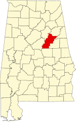
[ 3] Name on the Register
Image
Date listed[ 4]
Location
City or town
Description
1
Benjamin H. Averiett House Upload image August 28, 1986 (#86002034 ) State Route 8 33°08′25″N 86°22′21″W / 33.14028°N 86.37251°W / 33.14028; -86.37251 (Benjamin H. Averiett House ) Fayetteville
2
William Averiett House William Averiett House August 28, 1986 (#86002038 ) Off State Route 8 33°08′02″N 86°23′58″W / 33.133889°N 86.399444°W / 33.133889; -86.399444 (William Averiett House ) Fayetteville
3
Boxwood Boxwood June 9, 1983 (#83002983 ) 406 E. North St., E. 33°26′13″N 86°05′47″W / 33.43681°N 86.09652°W / 33.43681; -86.09652 (Boxwood ) Talladega
4
Charles Butler House Charles Butler House February 26, 1996 (#96000054 ) Junction of 1st St. and 10th Ave. 33°16′38″N 86°21′26″W / 33.27724°N 86.35729°W / 33.27724; -86.35729 (Charles Butler House ) Childersburg
5
B.B. Comer Memorial Library B.B. Comer Memorial Library September 6, 2005 (#05000972 ) 711 N. Broadway Ave. 33°10′39″N 86°15′04″W / 33.1775°N 86.251111°W / 33.1775; -86.251111 (B.B. Comer Memorial Library ) Sylacauga The building currently houses the Isabel Anderson Comer Museum & Arts Center
6
J.L.M. Curry House J.L.M. Curry House October 15, 1966 (#66000154 ) 3 mi (4.8 km) northeast of Talladega on State Route 21 33°27′17″N 86°03′06″W / 33.4546°N 86.0518°W / 33.4546; -86.0518 (J.L.M. Curry House ) Talladega
7
Elston House Upload image October 8, 1976 (#76000357 ) 10 mi (16 km) north of Talladega on Turner's Mill Rd. 33°32′49″N 86°01′05″W / 33.54701°N 86.01792°W / 33.54701; -86.01792 (Elston House ) Talladega
8
First Presbyterian Church First Presbyterian Church November 17, 1983 (#83003489 ) 130 North St., E. 33°26′10″N 86°06′03″W / 33.43606°N 86.10072°W / 33.43606; -86.10072 (First Presbyterian Church ) Talladega
9
Goodwin-Hamilton House Goodwin-Hamilton House August 28, 1986 (#86002041 ) Marble Valley Rd. 33°07′03″N 86°24′46″W / 33.1174°N 86.41291°W / 33.1174; -86.41291 (Goodwin-Hamilton House ) Fayetteville vicinity
10
Hightower Brothers Livery Stable Hightower Brothers Livery Stable July 3, 1997 (#97000650 ) 413 Norton Ave. 33°10′21″N 86°15′09″W / 33.17249°N 86.25255°W / 33.17249; -86.25255 (Hightower Brothers Livery Stable ) Sylacauga
11
Idlewild Idlewild October 15, 1993 (#93001012 ) State Route 5 , 0.1 mi (0.16 km) north of State Route 21 33°28′15″N 86°02′53″W / 33.47077°N 86.04805°W / 33.47077; -86.04805 (Idlewild ) Talladega
12
Jemison House Complex Jemison House Complex October 1, 1990 (#90001507 ) South of the junction of Chocolocco and Cheaha Creeks 33°32′02″N 86°02′44″W / 33.534°N 86.04554°W / 33.534; -86.04554 (Jemison House Complex ) Eastaboga
13
Kymulga Mill And Covered Bridge Kymulga Mill And Covered Bridge October 29, 1976 (#76000356 ) 4.5 mi (7.2 km) northeast of Childersburg on State Route 46 33°20′02″N 86°18′00″W / 33.33402°N 86.29999°W / 33.33402; -86.29999 (Kymulga Mill And Covered Bridge ) Childersburg
14
Lawler-Whiting House Lawler-Whiting House May 22, 1986 (#86001157 ) State Route 21 south of Talladega33°21′27″N 86°09′56″W / 33.35754°N 86.16556°W / 33.35754; -86.16556 (Lawler-Whiting House ) Talladega
15
Silk Stocking District Silk Stocking District December 13, 1979 (#79000403 ) Roughly bounded by Coffee, 2nd, McMillan, and Court Sts. 33°25′54″N 86°05′54″W / 33.431667°N 86.098333°W / 33.431667; -86.098333 (Silk Stocking District ) Talladega
16
Dudley Snow House Dudley Snow House February 4, 1982 (#82002000 ) Peek Dr. 33°35′01″N 85°48′41″W / 33.58366°N 85.81125°W / 33.58366; -85.81125 (Dudley Snow House ) Oxford Originally located at 704 Snow St. in Calhoun County ; moved to current location in the 1990s.[ 5]
17
Swayne Hall Swayne Hall December 2, 1974 (#74002223 ) Talladega College campus33°26′02″N 86°06′48″W / 33.43375°N 86.11339°W / 33.43375; -86.11339 (Swayne Hall ) Talladega
18
Sylacauga Historic Commercial District Sylacauga Historic Commercial District June 2, 2004 (#04000563 ) Roughly bounded by Broadway Ave., W. 1st., Anniston Ave., and W. 4th St. 33°10′14″N 86°15′08″W / 33.170556°N 86.252222°W / 33.170556; -86.252222 (Sylacauga Historic Commercial District ) Sylacauga
19
Talladega College Historic District Talladega College Historic District August 23, 1990 (#90001316 ) Junction of Battle St. and Martin Luther King Dr.; also 627 West Battle St. 33°26′00″N 86°06′51″W / 33.433333°N 86.114167°W / 33.433333; -86.114167 (Talladega College Historic District ) Talladega Boundary increase approved December 8, 2021.
20
Talladega County High School Upload image September 20, 2023 (#100009127 ) 181 Magnolia St. 33°36′20″N 86°07′08″W / 33.6055°N 86.1189°W / 33.6055; -86.1189 (Talladega County High School ) Lincoln
21
Talladega Courthouse Square Historic District Talladega Courthouse Square Historic District October 18, 1972 (#72000181 ) Courthouse Sq.; also roughly bounded by N. East, E. North, and S. East, and Coffee and Spring Sts. 33°26′06″N 86°06′09″W / 33.435°N 86.1025°W / 33.435; -86.1025 (Talladega Courthouse Square Historic District ) Talladega Second set of boundaries represent a boundary increase of June 30, 1988
22
Thornhill Thornhill February 20, 1998 (#98000104 ) 29229 State Route 21 33°24′09″N 86°08′34″W / 33.40244°N 86.14265°W / 33.40244; -86.14265 (Thornhill ) Talladega
23
William Watters House William Watters House September 25, 1987 (#87001652 ) County Highway 8 33°08′33″N 86°24′40″W / 33.14237°N 86.41105°W / 33.14237; -86.41105 (William Watters House ) Fayetteville
24
Welch-Averiett House Welch-Averiett House August 28, 1986 (#86002044 ) State Route 8 33°08′35″N 86°23′18″W / 33.14293°N 86.38842°W / 33.14293; -86.38842 (Welch-Averiett House ) Fayetteville
25
Winterboro Stagecoach Inn Winterboro Stagecoach Inn July 6, 2005 (#05000651 ) 22901 State Route 21 33°19′31″N 86°11′49″W / 33.3254°N 86.19689°W / 33.3254; -86.19689 (Winterboro Stagecoach Inn ) Winterboro


