[ 3] Name on the Register
Image
Date listed[ 4]
Location
City or town
Description
1
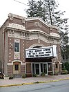
Anthracite Bank Building Anthracite Bank Building September 13, 1978 (#78002469 ) 133 West Broad Street 40°47′50″N 75°58′23″W / 40.7972°N 75.9731°W / 40.7972; -75.9731 (Anthracite Bank Building ) Tamaqua
2
Cloud Home Cloud Home May 22, 1978 (#78002465 ) 351 South 2nd Street 40°40′49″N 76°11′42″W / 40.6803°N 76.195°W / 40.6803; -76.195 (Cloud Home ) Pottsville
3
Fighter's Heaven Upload image August 21, 2023 (#100009238 ) 58 Sculps Hill Rd. 40°38′16″N 76°05′41″W / 40.6377°N 76.0946°W / 40.6377; -76.0946 (Fighter's Heaven ) Orwigsburg
4
Mothers' Memorial, Hoffman Memorial, and Veterans' Memorial Mothers' Memorial, Hoffman Memorial, and Veterans' Memorial September 17, 2020 (#SG100005552 ) North Hoffman Boulevard 40°47′01″N 76°20′14″W / 40.7837°N 76.3372°W / 40.7837; -76.3372 (Mothers' Memorial, Hoffman Memorial, and Veterans' Memorial ) Ashland
5
New Ringgold Gristmill New Ringgold Gristmill December 18, 1978 (#78002464 ) Legislative Route 53062 40°41′25″N 76°00′24″W / 40.6903°N 76.0067°W / 40.6903; -76.0067 (New Ringgold Gristmill ) East Brunswick Township
6
Nutting Hall Nutting Hall July 23, 1980 (#80003627 ) 205 South Tulpehocken Street 40°32′48″N 76°23′05″W / 40.5467°N 76.3847°W / 40.5467; -76.3847 (Nutting Hall ) Pine Grove
7
John O'Hara House John O'Hara House May 22, 1978 (#78002466 ) 606 Mahantongo Street 40°40′58″N 76°11′59″W / 40.6828°N 76.1997°W / 40.6828; -76.1997 (John O'Hara House ) Pottsville
8
George Ormrod House George Ormrod House June 14, 1977 (#77001193 ) 218 West Broad Street 40°47′48″N 75°58′25″W / 40.7967°N 75.9736°W / 40.7967; -75.9736 (George Ormrod House ) Tamaqua
9
Burd Patterson House Burd Patterson House April 27, 1995 (#95000515 ) 803 Mahantongo Street 40°40′53″N 76°12′02″W / 40.6814°N 76.2006°W / 40.6814; -76.2006 (Burd Patterson House ) Pottsville
10
Pine Grove Historic District Pine Grove Historic District December 31, 1987 (#87002210 ) South Tulpehocken and Mill Streets, and Swatara Creek 40°32′47″N 76°23′04″W / 40.5464°N 76.3844°W / 40.5464; -76.3844 (Pine Grove Historic District ) Pine Grove
11
Pottsville Armory Pottsville Armory November 14, 1991 (#91001701 ) 502 North Centre Street 40°41′28″N 76°11′54″W / 40.6911°N 76.1983°W / 40.6911; -76.1983 (Pottsville Armory ) Pottsville
12
Pottsville Downtown Historic District Pottsville Downtown Historic District March 1, 1982 (#82003819 ) Roughly bounded by Laurel Boulevard, Railroad, Morris and 4th Streets 40°40′59″N 76°11′41″W / 40.6831°N 76.1947°W / 40.6831; -76.1947 (Pottsville Downtown Historic District ) Pottsville
13
Reading Railroad Passenger Station–Tamaqua Reading Railroad Passenger Station–Tamaqua December 26, 1985 (#85003164 ) Off West Broad Street 40°47′52″N 75°58′14″W / 40.7978°N 75.9706°W / 40.7978; -75.9706 (Reading Railroad Passenger Station–Tamaqua ) Tamaqua
14
St. Paul's Union Church and Cemetery St. Paul's Union Church and Cemetery April 27, 1995 (#95000516 ) Junction of Township 798 and Legislative Route 4037, southwest corner, about 1 mile (1.6 km) east of Ringtown 40°51′33″N 76°12′38″W / 40.8592°N 76.2106°W / 40.8592; -76.2106 (St. Paul's Union Church and Cemetery ) Union Township
15
Schuylkill County Bridge No. 113 Schuylkill County Bridge No. 113 January 3, 1978 (#78002468 ) West of Rock off Pennsylvania Route 895 40°32′42″N 76°17′43″W / 40.545°N 76.2953°W / 40.545; -76.2953 (Schuylkill County Bridge No. 113 ) Washington Township
16
Schuylkill County Bridge No. 114 Schuylkill County Bridge No. 114 January 3, 1978 (#78002467 ) East of Rock off Pennsylvania Route 895 40°32′39″N 76°19′33″W / 40.5442°N 76.3258°W / 40.5442; -76.3258 (Schuylkill County Bridge No. 114 ) Washington Township
17
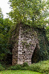
Swatara Furnace Swatara Furnace September 6, 1991 (#91001140 ) Old Forge Road east of Lebanon Reservoir, north of Suedberg 40°32′35″N 76°29′27″W / 40.5431°N 76.4908°W / 40.5431; -76.4908 (Swatara Furnace ) Pine Grove Township
18
Tamaqua Historic District Tamaqua Historic District February 2, 2001 (#01000059 ) Roughly bounded by the Odd Fellows Cemetery, Rowe and Mauch Street, East End Avenue, Mountain Avenue, and West Cottage Avenue 40°47′59″N 75°57′29″W / 40.7997°N 75.9581°W / 40.7997; -75.9581 (Tamaqua Historic District ) Tamaqua and Schuylkill Township
19
D.G. Yuengling and Son Brewing Complex D.G. Yuengling and Son Brewing Complex February 1, 1985 (#85000180 ) 5th and Mahantongo Streets 40°40′57″N 76°12′22″W / 40.6825°N 76.2061°W / 40.6825; -76.2061 (D.G. Yuengling and Son Brewing Complex ) Pottsville
20
Frank D. Yuengling Mansion Frank D. Yuengling Mansion April 18, 1979 (#79002342 ) 1440 Mahantongo Street 40°40′43″N 76°12′30″W / 40.6786°N 76.2083°W / 40.6786; -76.2083 (Frank D. Yuengling Mansion ) Pottsville


