From Wikipedia, the free encyclopedia
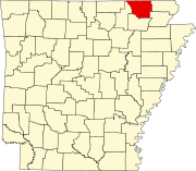
Location of Randolph County in Arkansas This is a list of the National Register of Historic Places listings in Randolph County, Arkansas .
This is intended to be a complete list of the properties and districts on the National Register of Historic Places in Randolph County , Arkansas , United States . The locations of National Register properties and districts for which the latitude and longitude coordinates are included below, may be seen in a map.[ 1]
There are 18 properties and districts listed on the National Register in the county. Another two properties were once listed but have been removed.
Contents: Counties in Arkansas
This National Park Service list is complete through NPS recent listings posted November 8, 2024. [ 2]
[ 3] Name on the Register[ 4]
Image
Date listed[ 5]
Location
City or town
Description
1
Bispham-Brown House Bispham-Brown House January 6, 2022 (#100007329 ) 705 North Marr St. 36°15′53″N 90°58′06″W / 36.2647°N 90.9683°W / 36.2647; -90.9683 (Bispham-Brown House ) Pocahontas
2
Campbell Cemetery Campbell Cemetery May 25, 2005 (#05000463 ) Off Muddy Ln., southeast of Imboden[ 6] 36°10′59″N 91°08′28″W / 36.1831°N 91.1411°W / 36.1831; -91.1411 (Campbell Cemetery ) Imboden
3
Cedar Grove School #81 Cedar Grove School #81 January 21, 2004 (#03001452 ) Approximately 5 miles north of Pocahontas along Highway 115 in the community of Brockett 36°19′57″N 90°57′06″W / 36.3325°N 90.951667°W / 36.3325; -90.951667 (Cedar Grove School #81 ) Pocahontas
4
Hillyard Cabin Hillyard Cabin August 16, 1994 (#94000851 ) Western side of Old Burr Rd., northeast of Warm Springs 36°29′02″N 91°02′04″W / 36.483889°N 91.034444°W / 36.483889; -91.034444 (Hillyard Cabin ) Warm Springs
5
Looney-French House Looney-French House September 23, 2004 (#04001035 ) 1325 Deer Run Trail 36°23′50″N 91°07′22″W / 36.397222°N 91.122778°W / 36.397222; -91.122778 (Looney-French House ) Dalton
6
Marr's Creek Bridge Upload image January 24, 2008 (#07001433 ) S. Bettis St. 36°15′29″N 90°58′19″W / 36.258059°N 90.972048°W / 36.258059; -90.972048 (Marr's Creek Bridge ) Pocahontas
7
Old Davidsonville Historic Site Old Davidsonville Historic Site January 18, 1974 (#74000499 ) Northeast of Black Rock on the Black River 36°09′23″N 91°03′23″W / 36.156389°N 91.056389°W / 36.156389; -91.056389 (Old Davidsonville Historic Site ) Black Rock
8
Old Randolph County Courthouse Old Randolph County Courthouse April 24, 1973 (#73000390 ) Broadway and Vance St. 36°15′38″N 90°58′10″W / 36.260556°N 90.969444°W / 36.260556; -90.969444 (Old Randolph County Courthouse ) Pocahontas
9
Old Union School Old Union School November 12, 1993 (#93001203 ) 504 Old Union Rd. 36°15′41″N 91°06′07″W / 36.261389°N 91.101944°W / 36.261389; -91.101944 (Old Union School ) Birdell
10
Old US 67, Biggers to Datto Old US 67, Biggers to Datto September 24, 2004 (#04001046 ) Biggers-Reyno Rd., 1st St., and County Road 111 36°21′35″N 90°46′37″W / 36.359722°N 90.776944°W / 36.359722; -90.776944 (Old US 67, Biggers to Datto ) Biggers Extends into Clay County
11
Pocahontas Commercial Historic District Pocahontas Commercial Historic District June 12, 2009 (#09000315 ) Roughly bounded by Rice, Thomasville, Jordan, and McDonald Sts. 36°15′41″N 90°58′14″W / 36.261508°N 90.970444°W / 36.261508; -90.970444 (Pocahontas Commercial Historic District ) Pocahontas
12
Pocahontas Federal Savings and Loan Pocahontas Federal Savings and Loan January 24, 2019 (#100003338 ) 201 W. Broadway St. 36°15′42″N 90°58′17″W / 36.2616°N 90.9715°W / 36.2616; -90.9715 (Pocahontas Federal Savings and Loan ) Pocahontas
13
Pocahontas Post Office Pocahontas Post Office May 16, 2002 (#02000488 ) 109 Van Bibber St. 36°15′43″N 90°58′16″W / 36.261944°N 90.971111°W / 36.261944; -90.971111 (Pocahontas Post Office ) Pocahontas
14
Randolph County Courthouse Randolph County Courthouse August 22, 1996 (#96000910 ) Southwestern corner of the junction of Broadway and N. Marr Sts. 36°15′39″N 90°58′16″W / 36.260833°N 90.971111°W / 36.260833; -90.971111 (Randolph County Courthouse ) Pocahontas
15
Ravenden Springs School Ravenden Springs School January 14, 2004 (#03001379 ) Highway 90 36°18′52″N 91°13′26″W / 36.314444°N 91.223889°W / 36.314444; -91.223889 (Ravenden Springs School ) Ravenden Springs
16
Rice-Upshaw House Rice-Upshaw House October 6, 2004 (#04001107 ) Highway 93 , 2 miles south of Dalton36°25′02″N 91°07′11″W / 36.417222°N 91.119722°W / 36.417222; -91.119722 (Rice-Upshaw House ) Dalton
17
St. Mary's AME Church-Pocahontas Colored School St. Mary's AME Church-Pocahontas Colored School August 5, 2002 (#02000830 ) 1708 Archer St. 36°15′44″N 90°58′53″W / 36.262222°N 90.981389°W / 36.262222; -90.981389 (St. Mary's AME Church-Pocahontas Colored School ) Pocahontas
18
Yadkin Church Yadkin Church May 30, 2019 (#100004003 ) Western side of Upper James Creek Rd. approximately 1 mile north of the junction with Lower James Creek Rd. 36°22′45″N 91°14′46″W / 36.379167°N 91.246111°W / 36.379167; -91.246111 (Yadkin Church ) Ravenden Springs
^ The latitude and longitude information provided in this table was derived originally from the National Register Information System, which has been found to be fairly accurate for about 99% of listings. Some locations in this table may have been corrected to current GPS standards.
^ National Park Service, United States Department of the Interior , "National Register of Historic Places: Weekly List Actions" , retrieved November 8, 2024.
^ a b Numbers represent an alphabetical ordering by significant words. Various colorings, defined here , differentiate National Historic Landmarks and historic districts from other NRHP buildings, structures, sites or objects.
^ "National Register Information System" . National Register of Historic Places National Park Service . March 13, 2009.^ The eight-digit number below each date is the number assigned to each location in the National Register Information System database, which can be viewed by clicking the number.
^ Location derived from its GNIS feature record ; the NRIS lists the site as "Address Restricted"
^ National Archives
Topics Lists by state Lists by insular areas Lists by associated state Other areas Related


